
The morning was overcast and I awoke with a vision of Vancouver. I noticed there was a woman who seemed to be living aboard one boat and three men on another at the Govt. dock, so I thought to myself, “they must shower somewhere.” So I asked the woman and it turns out there are showers for the Govt. dock in Snug Cove. Who’d of thought? In Canada, the Govt. dock is a fairly common thing. Often they are used by fishing vessels, but in Bowen Island it is more used by folks coming over from the mainland on day trips to go to the Union Steamship Company Marina Resort, local restaurants tchotchke shops, and by water taxis. You pay by the honor system and it’s very economical with no amenities. For the head, you use the one provided nearby for public use and the ferry passengers. It turns out the shower was actually at the Resort, by the laundry room, but seperate from the facilities they have for their marina customers. It was rather nice so I enjoyed the hot water and my once a week shower.
I did some other chores and made ready to leave. As I was about to push-off, the ferry, the Queen of Capilano, came into the cove. It seemed prudent to wait for it to leave so as not to be subject to the prop wash that it was making and to not interfere with their operation. After it left, I started the motor but realized that I still needed the wash to settle down as it makes a tremendous amount of unpredictable swirling currents in the cove. While waiting, a Tollycraft with no fewer than 7 aboard comes into the Cove and was going to pull up to the dock on the opposite side. They saw me and asked if it was alright to dock there. In hindsight, I really wish I had said yes, but instead I explained that I wasn’t sure and that the signage said it was reserved for winter moorage a couple more days. So they aborted that spot and came over to my side. I said to them that they needed to wait until the ferry wash settled down, as I was doing, but they apparently did not understand. They made their approach and the current had its way with them. This became my problem because the current carried their boat uncontrollably into mine. I was in a bit of an uncompromising position as I was on the dock with my bow line in my hand when this happened. The many crew managed to fend off for the most part with only their rub rail making contact with my port side stantion and hull. That annoyed me and I emphatically expressed that it was imperative that they do not hit my outboard on the way in. My wordage at the time was much different. They managed to get to the dock without any further contact and I tied back up and inspected for damage and decided there wasn’t any and to not take further action concerning liability. There were apologies and lots of playing dumb on their end and they asked if they could help me in my departure. My words said “In light of what just happened I would very much prefer to do it myself.” My tone said “I don’t like you very much right now and I trust you even less.”

Point Atkinson, From Satellite……

…and From the Boat. Vancouver in the Background.
Looking Back at Howe Sound
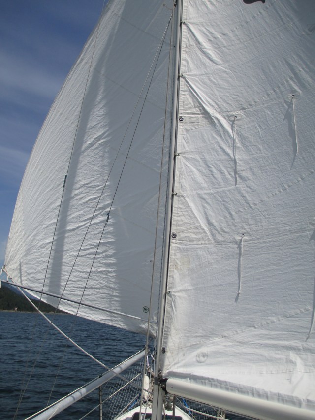
I got off the dock without further incident and motored out of the cove. Once out, there was an outflow breeze from Howe Sound and I raised the jib and the main and broad reached toward Vancouver. Once to Point Atkinson though, I started to lose the outflow and the wind became light and variable. I made it around the point but I could see how you might want to give it a wider berth as the currents here tend to push you in its direction. I tried to work the boat the best I could in that light air, but finally gave in and motored through English Bay. I wanted to get into False Creek and secure an anchoring spot and permit before it was too late in the day.

English Bay. A moorage field for large ships awaiting loading and off-loading in Vancouver’s ports. English Bay is called such as this is where Captain Vancouver moored his fleet while exploring the area. The shoal area in the lower left corner is called the Spanish Banks, because that is where the Spanish fleet was moored at the same time.
I have been to False Creek previously and have gotten an anchoring permit before. Vancouver has implemented an anchoring permit system in an effort to keep live-aboards with unseaworthy boats from permanently mooring within the Creek. The permit is free and allows you to anchor 14 days out of the month in False Creek. Each month you can get a new permit. For the rest of the time, you must go elsewhere, which for the live-aboards appears to be out in English Bay near the entrance to the Creek. I assure you, that is a very exposed place to anchor and at times, terribly so. The gist is that if your boat can’t move, it would be considered unseaworthy and subject to a fine of $500 and/or impounding. This is the state of affairs and it creates quite a dynamic in the Creek. Once you observe it for a couple of days it is all very easy to understand.
The guide books explain that you must go to Stamps Landing to get your permit, yet the boating magazine 48 North had a current advertisement saying that there are three locations to get your permit. Go directly to Stamps Landing. False Creek Fuels is one of the faux locations. I stopped there first as I wanted to top up on fuel and was told I could get one at the Boaters’ Welcoming Center. After refueling I went to the Center, which also was on my way to the anchoring spot and the nice gentleman said I would have to go to Stamps Landing as they were the only ones to give out permits. He stated that I didn’t really need one as it was really meant for the live-aboards and that the City wanted me to be able to anchor here and visit. Without the Permit System, the live-aboards would monopolize the anchorage and visiting boats would not have room to anchor. While I did not inquire what a slip at a marina would cost, I suspect it to be a turn off to some thrifty Canadians (and myself.)

False Creek.
The image is not real-time, but you can see the plethora of boats anchored inside False Creek. Also visible is the park/green space surrounding the Creek.
I moved on to where I wanted to anchor and found a spot on the edge of the field. This was luck and strategy. Luck because there was a place for me, strategy because I wanted to be on the edge so as not to be completely surrounded by other anchoring and swinging boats. Once anchored and set, I pumped up the kayak and paddled over to Stamps Landing to get my permit. I had intended to play by the rules and get the permit as I “had no plan with the man” and it seemed prudent to do so. Seeing as I was only going to be there a couple of days, I really believe I did not need to have one and it appeared like many others did not bother. Still, it was free and easy enough. It is easy to tell the live-aboards from the tourists. The live-aboards have boats that don’t look like they are sailed often or ever (sailed, as in used to travel, whether sailboat or powerboat), and the tourists do. Because they do not travel, these aspects of the boat are typically neglected and this can be easily observed. If you are not investing in your boat, living at anchor is very low rent.
I locked up the boat, used an anchor chain to lock the outboard to the boat, figured out a way to lock the dinghy up and paddled ashore. Vancouver is notorious for vehicle break ins, so I figure that boats could also be subject to this. False Creek is surrounded by a park. This park provided public space, green space, bike and pedestrian lanes, water taxi docks and there are places to tie up your dinghy for free too. Tennis courts, monuments, historical information, benches and other curiosities are abundant. The Creek is surrounded by marinas and house boats and very little heavy industry. It appears to be well enjoyed by the inhabitants of the city on a summer day and gives the city a very European and progressive feel. At least in the park. In venturing out of the green space, it reminded me of Seattle and any other urban area, a money suck with noise and pollution and everyone on their cell phone running the rat race. Impressive, if you find those things impressive. I managed to escape the streets unscathed physically and financially, realizing it had nothing to offer me on this trip and retreated back to the green space and the Creek.
I paddled back to the boat and locked up the kayak. I checked that the anchor was doing as I expected, enjoyed the sunset, turned on the anchor light, ate some grub and watched the “circus” from the comfort of my own tiny, traveling, floating home.
Stats: TO – 11.31NM, MS – 6.1kts, MA – 3.4kts, TT – 3hrs, 50 mins, AD – ~18ft, AS – 60ft.
Misc.: 135mins of motor time, refueled, sussed locking up operations, reminded to not trust others and their boats.

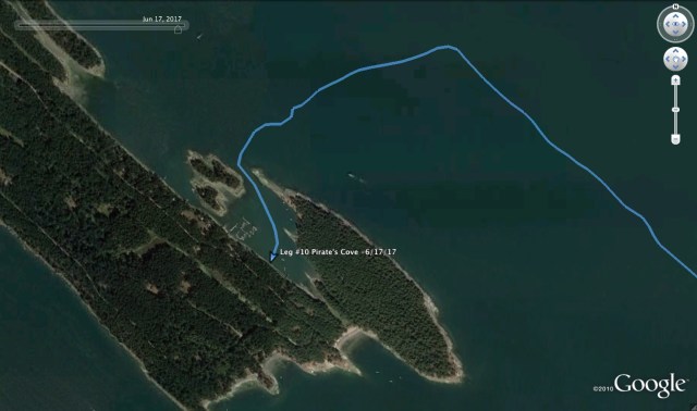
We weighed anchor at 9:50am after breakfast, more water runs and boat chores. The stern tie came off without a hitch and the handle I attached to the spool for cranking in the line worked well. Once the stern tie was safely aboard, I deflated the kayak as towing it across the Strait of Georgia should only be done in settled whether. The south wind was blowing pretty good so I wasn’t going to chance the painter separating on the Strait. The Strait of Georgia with a good wind can be a lot of fun, or a nightmare, depending on how you interpret it. There can be a lot of current in the Strait and if a strong wind opposes it, big, steep waves will occur. The fetch should be 100 miles. Crossing it is not be taken lightly. This would be my fifth time crossing it and I have seen conditions from 20kts to a dead calm. Personally, I prefer some wind as the boat and I like to sail better than we like to motor. It’s good experience as it can be one of the bigger challenges of the inside passage. I left Pirates Cove using the same range that I obeyed on the way in, but it was a little trickier as the wind was blowing from behind and the range was observed from behind. It is typically easier to maneuver a boat when heading into the wind and current and as you can imagine, easier to keep a range lined up when it is in front of you instead of behind you. I wasn’t particularly pleased on how it went, however, I didn’t hit anything, so it was a success.
Once out of Pirates Cove, I traveled east over Pylades Channel as my plan was to go through Gabriola Passage. I have never used this pass before, but like most of the major passes in and out of the Gulf Islands, it is safest to travel near slack water. Currents can hit up to 8 knots on a spring tide. There were some tugs putting together a log boom, headed in my direction and my timing was right on, so I started the motor and got the jump on them. To have not gotten in before them would have meant a wait, stronger current and more possibility for debris in the water. I met some boats coming the other way and they may have had to wait out the tugs as the narrow spot of the pass would not have allowed that kind of 2-way traffic. On the Straight side, there are some reefs to mind on the exit as well as the offshore rocks, Gabriola Reefs. It seemed as this would be easy at first, but I soon realized, not so much. The flood was stronger than I expected and I believe the Frazier River freshet was pushing me north, plus the wind was out of the south. All three forces were pushing me north, in the direction of the reef, but I tacked a couple of times and used a little iron wind to just be sure.
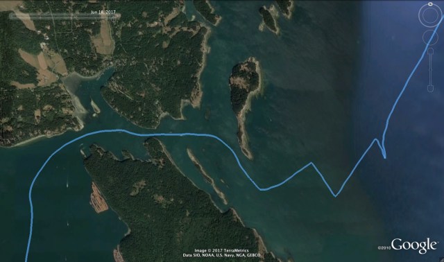
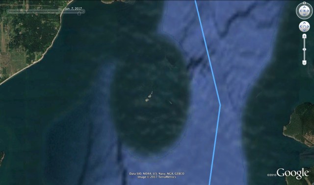
Gabriola Passage. Notice the log boom staging area in the lower left corner and the narrow bit in the center left.
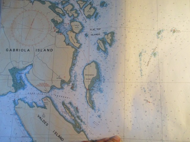 The Canadian Hydrographic Chart shows the reefs in the Passage and Gabriola Reefs in the upper right that you cannot see on Google Earth.
After that excitement, the wind steadily diminished as I crossed the Strait until there was not enough wind to keep the sails full in the still rolly seas.
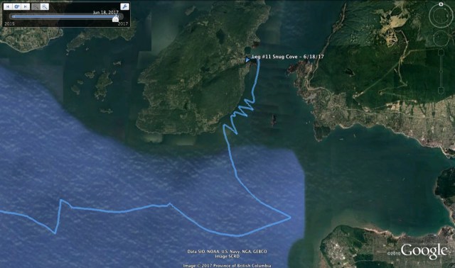
My original destination was intended to be False Creek in Vancouver, however the strong forces that drove me north put an end to that idea. I motored for a little bit, getting my bearings and trying to figure out where to go. The air was hazy and the Strait of Georgia is about 20 miles wide, so piloting can be a bit tricky. You can see land, but “which land is it?” I motored in the Vancouver direction until the seas settled a little and I realized that I was picking up some outflow wind from Howe Sound. Howe Sound is the fjord just north of Vancouver and it has its own weather patterns and forecast. Thermal winds play a big part in its weather and in this instance there was an outflow that I was feeling. I thought, “maybe I can make Vancouver after all,” but alas, this was wishful thinking. As I approached Vancouver the wind both slowed and backed as I moved out of the airflow. So I tacked over and decided to stay in the wind and see if I could make it to Snug Harbor, on Bowen Island, just inside Howe Sound. I had been to Snug Harbor on a previous trip and I knew there was a possible anchorage and a government dock.

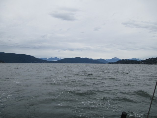
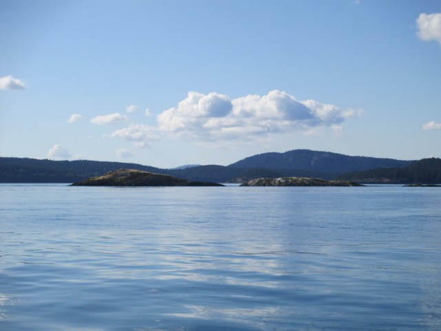
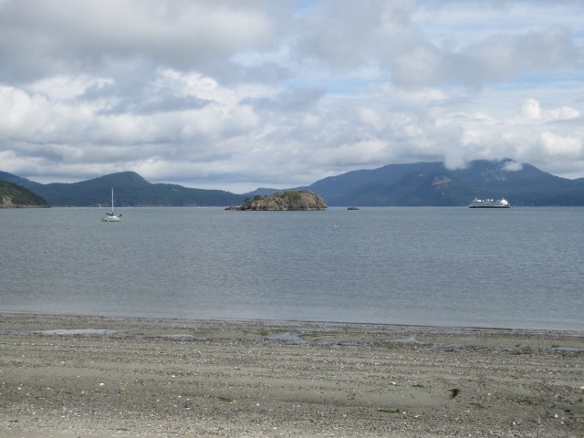
Slow progress against wind and current at the mouth of Howe Sound.
The wind was good, but dead ahead, and I did not have the tides on my side, so progress was very slow. I had expected to have some tidal help but I had it wrong. There may have also been some heavy fresh water outflow too, from Howe sound, as we were in the middle of the June mountain snow melt. In fact, there was a regular Securite on the VHF channel 16 from the Coast Guard warning mariners about the heavy amount of debris in the Strait of Georgia from the Frazier River runoff due to the heavy snows they had this winter. I can confirm it to be true. I was on the constant look out and often adjusting course to avoid floating logs and debris when I was on the east side of the Straight.
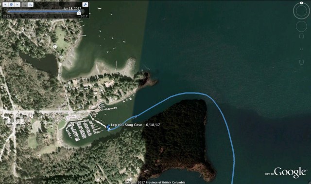
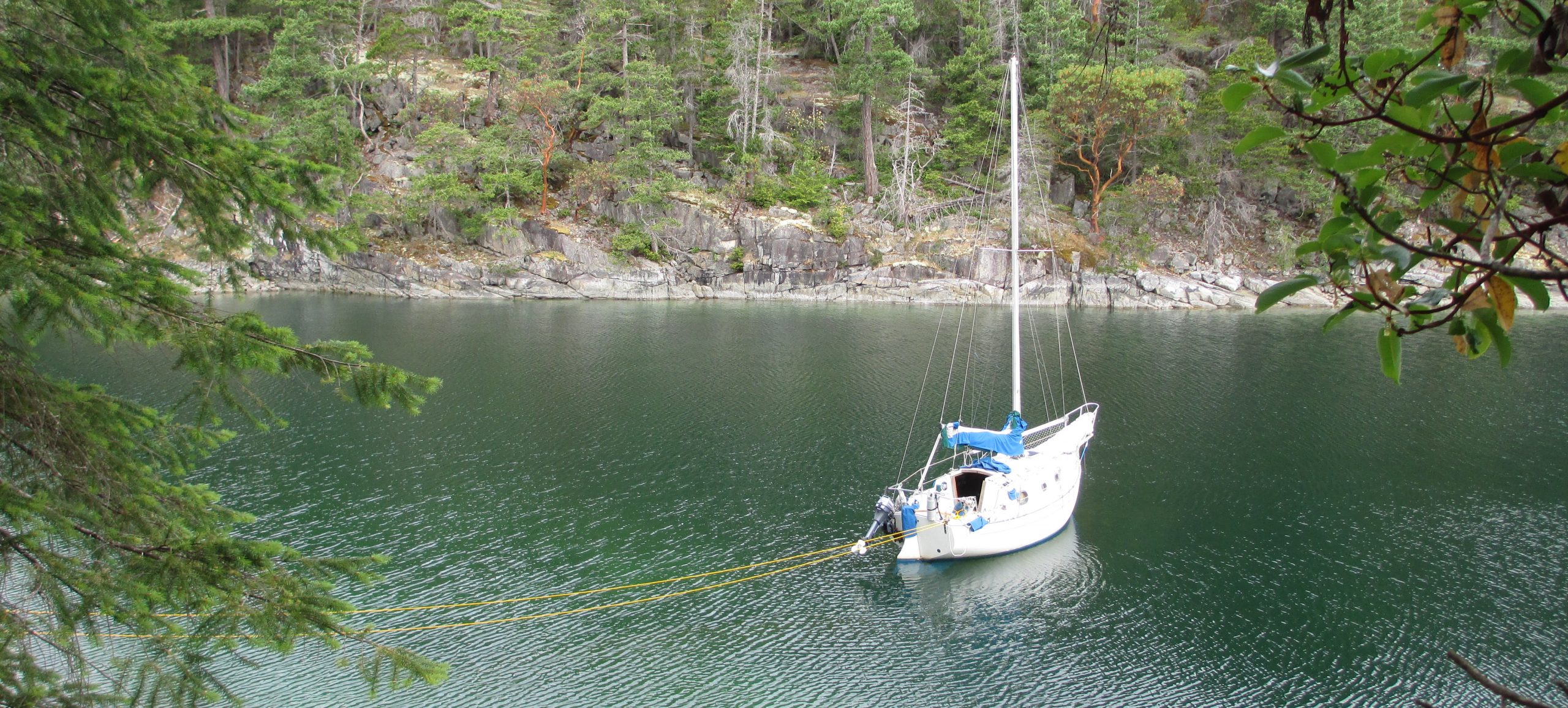
I was running out of light, so I wanted to get into a port, especially with the debris around, so I finally gave in and motored into Snug Harbor. It turns out the favorable side of the government dock was still reserved for winter moorage, so I ended up on the ferry side of the dock. You are exposed to a bit more turbulence from the ferry wash but it was manageable and for $8US, expectations need to be low. The anchorage did not look too promising as there were a lot of permanent boats in there and I did not have the kayak inflated. Inflating the kayak is a good half hour production and I had my mind set on having a beer at the local pub and using their internet connection for some modern world communications. I got the boat settled on the dock, paid my fee and headed to the pub. After my beer and internet, I headed back to the boat, tidied up and settled in for the night. It had been a 12 hour day of boating, which was long for this trip so far. 
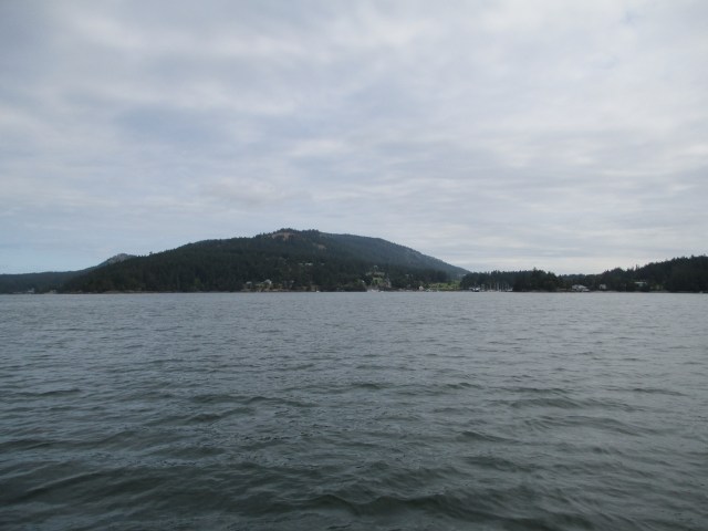
Sampaguita and the view out of Snug Cove.

The Queen of Capilano comes and goes quite regularly to the mainland during the day. Their propeller sound resonates throughout your boat.
Stats: TO – 40.4NM, MS – 6.6kts, MA – 3.5kts, TT – 11hrs 54mins
Misc. : Motor time – ~180mins, govt. dock moorage – $12CAN, Beer and Internet – ~ $8 CAN

Sorry, no Johnny Depp stories. I left Annette Inlet with a subtle south wind and I jibed out into Trincomali Channel. The tide was ebbing, which was not favorable for my direction, but the wind was adequate to make good headway. I was not sure where I was destined on this day as there are lots of options in the Gulf Islands. I have been through here several times before. The downside is I have seen much of it, the upside is the anchorages and possibilities are not a mystery. I wanted to go to a new spot, but knew I could seek shelter in an old one if necessary. I would wait and see how the wind behaved before I settled on where to go.
The sun was out and the south wind continued to build. After two long legs in Trincomali Channel, I decided I would try wing and wing. The wind needs to hit a certain velocity before this works well with my boat, otherwise the going is slow, the steering is tedious and the sails are floppy. It has to do with the apparent wind and you want the sails to breathe, which is to have the wind overflow from the main and spill into the jib. Then the boat will go at a steady 4 knots and more. The advantage is I can sail dead downwind in a straight line. The disadvantage is it takes every bit of my concentration, all of the time, to make sure that no accidental jibes happen and you keep both sails full. I rig a preventer, which is a line connecting the boom to the sail track on the same side of the boat. This prevents the boom from suddenly swinging across the boat if the wind catches the back side of the sail. If it weren’t to take my head off on the way across, it can put shock loads on the hardware and attachments from the uncontrolled sweep. It also keeps the main sail from pumping, which is caused by the boom moving up and down from wind gusts and rolling seas, which changes the sail shape, causes the sail to chafe on the shrouds, causes weather helm and slows the boat down. It doesn’t however, keep the boat on course, which is up to the helmsman.

Wing and Wing Course
The are a couple of below the water obstructions in the middle of Trincomali Channel, chiefly, Governor’s Rock and Victoria Shoal, but these have buoys marking them and my path goes near them, but not over them. When sailing wing and wing, you don’t have much directional option unless you flip a sail over for a broad reach which means a 30 degree course change in order to keep the sails full.
Wing and Wing
The south wind continued to build while on wing and wing and the boat was going at nearly hull speed. To boot, the ebbing tide and opposing wind were building up a choppy sea. I was very exciting and very intense. No snacks or ducking down below for a moment as the helm needed constant attention. However, the heading was straight where I wanted to go, so I was making the most of it. I kept asking myself if I should reef, which is usually a sign that you should, but I was holding off with a balance of fear, speed and hunger. I had decided the wind would likely hold through the day and getting to Pirate’s Cove became a solid destination unless it built so much I chickened out and ducked in somewhere for protection. There were large ships at anchor inside the Islands off of Porlier Pass and I decided to avoid them by heading to the west side of Hall and Reid Islands. In prep for this, I ended the wing and wing and moved to broad reaching. I put a reef in the main as the wind had built to the point of discomfort. I increased the length of the kayak painter so that it rode a little better in the waves, I was towing it, and once behind Hall Island, I put the second reef in the main and the boat seemed to like this.

Broad Reaching and Reefing
Ironically, once beyond Reid Island, the wind began to let up a bit and I broad reached back across Trincomali Channel, headed to Pylades Channel. I needed to shake out the reefs to keep the boat moving. I was happy to have a bit of respite from the wind, but the cost is a slower moving boat which can mean going from a joggers pace to a walkers pace. This does matter and the slower pace can double your ETA. After some more wing and wing with wind that was barely strong enough, I cruised up Pylades Channel and made my final approach to Pirates Cove.
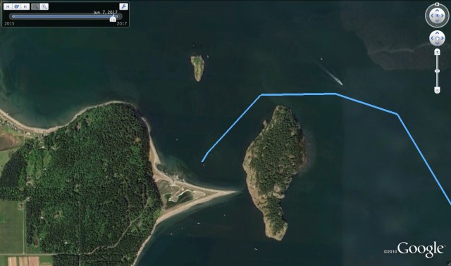
Entering Pirate’s Cove

Line Up the Arrow and the X
I don’t know how Pirate’s Cove got its name but it has a tricky entrance between submerged reefs. As you approach the entrance, you need to line up the range, a painted arrow and a painted X you see on shore. These do not seem like official navigation aids, but it is correct and you best mind it coming and going. Once to an undefined point between the parallel reefs, you make a 90 degree port turn and then aim for the center of the entrance buoys. Once through the buoys you are generally OK and then you find a spot to anchor and preferably stern tie. The cove is small so a stern tie gives more room for others and guides say that the holding in the center of the cove is not so good. With the ride I had earlier in the day, I wasn’t going to chance that. A stern tie line, which is a line you attach to the back of your boat and then take ashore. On shore you attach it to a tree, or in this case, to iron rings in the bank set for just this purpose by the Canadian Provincial Marine Parks, and then back to your stern. Thus the name, stern tie. This, in opposition to the anchor you set off your bow, keeps your boat positioned in one spot. Otherwise, with just an anchor off the bow, your boat could swing in a full circle depending on wind and current. A stern tie keeps you from both swinging into undesirable, immovable, hard objects, and other boats. More boats can squeeze into the same anchorage, so it is a polite thing to do too.
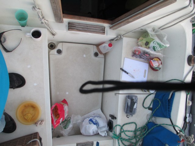
I was excited to try out my new stern tie creation as well. Many folks keep their stern line in a spool permanently attached to, you guessed it, the stern of their boats. My small boat has limited room for a permanent installation, especially considering that it is 300ft of line. I keep my spool, which was an empty freebie from Fisheries Supply, stowed below the v-berth. While it takes a little forethought to use, I do not use it often, and it keeps the polypropylene (because it floats) line out of the sun’s UV radiation and is one of those small boat consequences. I whittled a piece of wood to fit in the top of my sheet winches and then I put the spool on that. This allows me to get in the kayak and paddle with the line to the shore as the spool turns and lets out the line. While the invention works like a charm, it took a few tries to judge the distances, get the anchor rode length right and keep the line untwisted. I used most of the 300ft of line. You take the line ashore and back, so that when you are ready to leave, you do not need to go ashore, but rather untie one end and pull it through while still on the boat. You use a floating line so that 1) it can be seen, so other boats know it is there, and 2) it is less likely to get caught in your motors propeller when you leave.
Once settled in, I took a hike on the trails in the small Provincial Marine Park, stock up on water from the well and eat some dinner. The water comes from a hand pump like my neighbor had in the 70s in rural upstate NY and the trails, while short, go over some rugged rocky terrain. There is a Pirate’s chest full of children’s toys by the Park sign and a light rain kept the air fresh and cool.
Booty
A Light Rain.
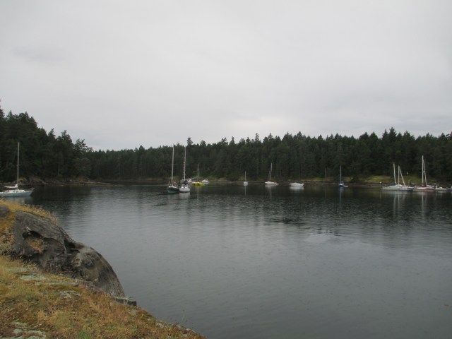
Sampaguita is the little boat in the middle on the far shore.

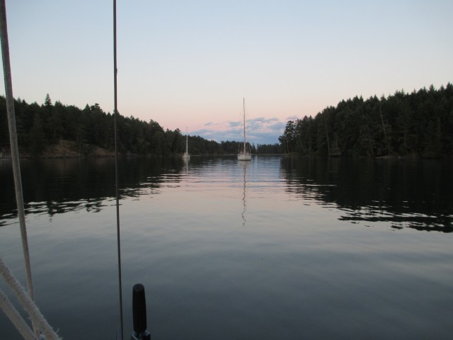
Sampaguita set to anchor and a stern tie.
Stats: TO – 24.92NM, MS – 6.4kt, MA – 3.9kt, TT – 7hr 3 min, AD – 20ft, AS – 70ft, SL – 280ft
Misc. – Motored into Pirates cove and then had motor idling a bit while I fussed with the stern line. Wind likely went to 15-20kts on trip.

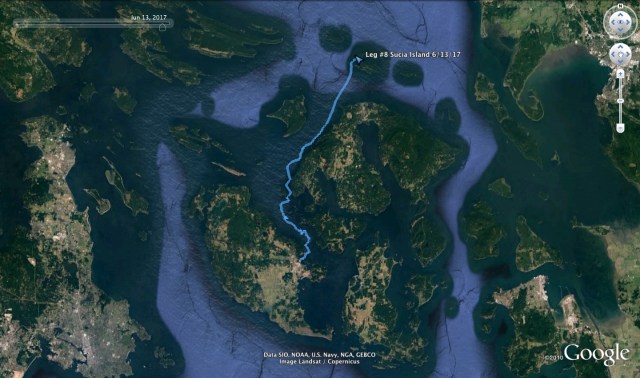
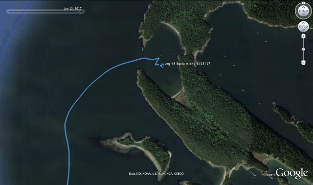
O Canada! I left Sucia in a nice SE breeze, sailing off the anchor and out of Shallow Bay. The wind was fitful in the bay, as to be expected, because it provided good protection from the SE, but once clear, progress was great. Fair winds as they say. I guided the boat through the islets just north of Waldren Island and dodged a couple freighters heading across Boundary Pass. This is the strip of water that separates the US San Juan Islands from the Canadian Gulf Islands and is a major shipping channel. Beautiful skies and clear visibility made it a safe crossing. I headed to Bedwell Harbor in South Pender Island, a Canadian customs check in station. This will be the third time that I have used this station so its old hat for me and I decide to see if I could sail up to the customs dock. There are already three boats on the dock as it was a busy day. I make it into the dock area, but the winds, blocked by the surrounding bluffs, become variable and unpredictable, so at the last moment I lower the motor and start it up. The landing required a quick burst of of reverse to stick and and I hopped off and secured the lines.

Bedwell Harbor
Canadian customs check-in has always been a fairly easy affair on my boat. When you land your crew can get off the boat to help with the lines(I have no crew) and then they are supposed to get back on the boat. Only the captain (that’s me) is allowed to leave the boat with everyone’s passports, info (only mine) and ships papers and proceed. You go to a designated check in station ( I’m there already) and you pick up one of the telephones marked for this purpose. It automatically dials Ottawa and connects you to an agent. They ask a few questions about who you are, how many people on board, your purpose, how long you plan to stay, do you have any alcohol on board and your boats registration number. I can tell I am in there data base already by the brevity and then they ask if I am bringing in any live plants or animals. The answers are short and correct. “Enjoy your stay.” The conversation lasted about a minute. There is always the possibility they will ask you to wait while officials come out and meet with you. The officials may be there already or they may need to come in from who knows where by skiff. I have never had this happen on my boat. In fact, if there are officials there already, they will tell you to use the phone process and Ottawa will inform them if they need to speak with you. Its all very awkwardly simple.
So, after my one minute phone conversation, I hop back on the boat, start the motor and pull off the dock. I have the sails up in no time and beat my way out of the harbor. I go through a strange lull in the breeze where I am bounced around in the rip and chop while trying to prepare and eat a lunch of cheese sandwiches. The wind fills in and I broad reach my way up Swanson Channel with the jib and a reefed main at 4.5-5 knots. It is Friday, so I consider going to Ganges on Salt Spring Island as I have heard from multiple sources that they have a great Saturday Farmer’s Market. I think it through and decide against it because, a)the wind is blowing good from the south and the anchorage there is very open from that direction so I am likely to be exposed to a bit of chop and discomfort. b) I do not want to stay in a marina and I prefer to not be in the crowds. c) I do not need provisions at this time and since I do not gravitate toward the shopping experience, the utility and entertainment is lost on me.

Annette Inlet
I decide I will give Annette Inlet on Prevost Island a go. It looks well protected and shallow. The entrance has a couple of difficult to see obstructions to look out for but the tide is on the rise so I am feeling confident. I am not bold enough to sail into this narrow and shallow inlet, so I start the motor at its entrance. There are a few boats in the inlet already but I easily find a place of my own and I anchor in about 15 ft of water and put out 70 ft of scope. The kayak is in tow so after I go through my post sail routine, I go for a paddle to the head of the inlet observing the geese and herons and getting some exercise. There are a couple more boats anchored further in that can’t be seen from the Flicka, so my spot is both good and as good as it gets. Another boat comes in while I am out and there are a total of 6 boats for the night.
Looking In

Looking Out
Stats: TO – 27.61NM, MS – 6.3kts, MA – 3.6kts, TT – 8hr 23min, AD – 15ft, AS – 70ft
Misc: Motor Time – 45mins (A little bit at the customs dock and getting into Annette Inlet)

I highly recommend a visit to Sucia Island in the San Juans Archipelago. This was my first time and am glad I finally made it. Its location on the northern border of the San Juans has been a deterrent for me in earlier trips as it was not in route to my previous destinations. I also read that there can be up to 700 boats here which is not the density I am searching for. June is early in the season, it is midweek, the weather forecast may be a deterrent, and curiosity has won out over stubbornness.
I first went ashore for a hike to Fossil Bay, the southernmost bay on the horseshoe-shaped Sucia Island. This is a more popular anchorage and the center of services including water, restrooms, docks, pavilions, and campsites. Shallow Bay, where I was anchored, has an outhouse but the closest fresh water is at Fossil Bay. I was sussing this out for future needs.
My walk took me up on some bluffs which provided good exercise and a great view for my lunch of cheese and hard-boiled eggs. One of the tricks for hard-boiling eggs is the rinsing technique which makes them easy to peel. On a boat with limited water supply and a hand pump, the amount of cold water necessary to rinse and cool the eggs quick enough to separate them from their shells is impractical. I suppose dipping them in the sea is a possible solution that I have not yet tried. For now, we’ll add this to the list of small boat disadvantages.
I witnessed some crows being opportunistic on a kayaker’s unguarded provisions. This is quite a common occurrence in Washington State Parks. Crows are smart and quickly learn that bright packaging can mean tasty treats. I learned to guard against this several years ago when canoe camping on Vashon and Blake Island in Puget Sound. To a crow, twelve cent ramen can have million dollar packaging.

A fossil I found lying on the beach

A Fossil in the Bluff

Where the Fossils Are
As I came down off the bluffs and got over my tunnel vision for exercise, I read some interpretive signage the park offers. It explained the different geological eras that made up the island. The southernmost strip of land, which I was just hiking on, was 70 million years old. The rest of the island is made of rock only 50 million years old. The earth has been folded and lifted, which explains the different ages. The older area of land incorporates Fossil Bay, aptly named for the fossils that can be seen in the cliffs and on the ground. I was very excited because fossils are cool. Thinking about life 70 million years ago, in comparison to now, sends me down a heady philosophical path.
Since the tide was out, the best part was accessible. I was able to walk along the inside shore and what I found was pretty awesome. We all know that when we hold a rock, it is likely millions of years old. To put a specific number on it is even headier. It took quite a bit to resist the temptation of taking one, which, of course, would be illegal and unethical. Luckily, I have a small boat with limited storage to keep me honest. We’ll call that a small boat advantage.
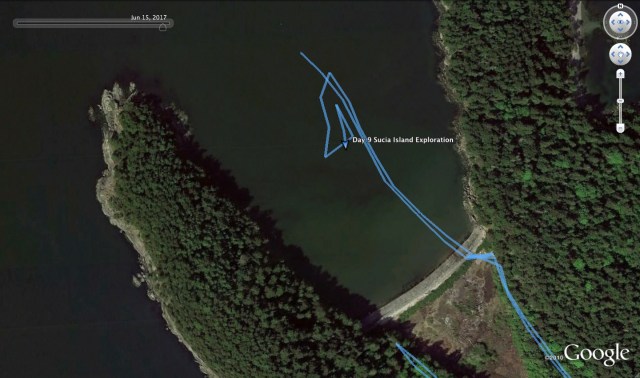
Re-anchoring

Water Runs
After my geological survey, I filled my water jugs from the fresh water tap and headed back to the boat. With a storm in the forecast, I was contemplating re-anchoring the boat further into the southern part of Shallow Bay. This was finally decided by Cliff and his family who picked up the buoy that Sampaguita was relatively close to. They were up from Portland and chartered a sailboat out of Bellingham for the week. They had stopped in Shallow Bay for the night before heading to the Canadian Gulf Islands the following day. So I got into the kayak and did some leadline depth sounding and tidal height sussing. I then moved the boat (by the motor) into a new location, for better protection from the predicted SE winds.
While anchoring etiquette follows a “first arrival” protocol, this doesn’t apply to permanent moorings in the State Park. My choice to anchor rather than pick up a buoy was two-fold. First, I did not know the integrity of the mooring buoy set up, while I did know my own ground tackle. I have read stories about boats adrift, attached to a WSP mooring buoy. Second, mooring buoys incur a fee and anchoring does not. I have already invested in my own tackle. I also want to test my gear and my choices for future confidence.
In the evening I took another hike, this time to the north side of the island. Then, I did some wildlife viewing from the kayak in the bay. Herons, otters, and eagles top the list. As the sun sets, I paddled by Cliff’s boat, and he invited me aboard for a Scotch. While not typically a Scotch drinker, I suspected it would be good. I accepted, and he, his family, and I chat about boats (of course), border crossings, dentistry, and the game, Magic: the Gathering.
The last comes from the unfortunate question of what I did for money. If they don’t know the game already, I find it nearly impossible for people, especially older ones, to comprehend what it is. Personally, I prefer questions like “what is it you do when you are not sailing?” This way, people are not defined by what they do for money, which for many, is whatever they have to. It opens up the conversation to more personal interests and passions. You’re odds of getting more interesting and excited answers increases. If they decide to talk about their job, that is their call. Not so coincidentally, this is a technique I use while talking to clients at my, would you guess, job.
Shallow Bay lends itself to warming in the summer sun and is a good place to see bio-luminescence. This is caused by tiny organisms in the water that, when agitated, give off a glow. On my kayak trip back to the Flicka from Cliff’s boat, moving through the water easily set it off, as did swimming fish. Pretty much anything moving in the water does. I have heard of people seeing it in their boat’s head when flushing too. The warmer the water, the more you will see. The most extraordinary bio-luminescence experience I have witnessed was in Mosquito Bay on the island of Vieques, in Puerto Rico. You can rent a kayak and paddle in the bay. It is like being in water that is on fire. It is incredible. If you are ever there, GO.

Fossil Bay during the Storm

Shallow Bay during the Storm. Sampaguita is to the left.
I awoke the next morning to building wind with maximum speeds predicted up to 30-40 mph. My plan was to stay on the boat and ride it out while keeping an eye on the anchor, doing boat chores, reading, and napping. The least successful of these was napping, but this is not surprising. That would mean I was relaxed about the anchor part.
I sewed my mainsail cover whose stitching was rotting out from the sun, mildew, and age. This time I used a wax thread for whipping line and hand sewed it with a sail stitching needle. It will likely outlast the cover now.
I boiled all the eggs I had and cooked all the potatoes I had. My next stop was Canada where uncooked eggs and potatoes were prohibited to import. The eggs, due to avian influenza and the potatoes, because of competition.
I did the dishes, tidied up, and adjusted the riding sail on the stern of the boat. This is a small handmade sail that I attached to one of the backstays. Its purpose was to mitigate Sampaguita’s “sailing” at anchor. Because of her high bow, low stern, nylon anchor rode, the currents and whatever other windage factors that come into play, she won’t sit steadily with the bow into the wind while at anchor. This means she is constantly in motion back and forth across the wind. The riding sail adds more windage area to the stern, acting as a weather vane.
The wind was gusty, but the anchorage a good choice. I had out plenty of scope and the boat, while sailing back and forth, is still firmly anchored to the seafloor. After hours of chores and worrying about the boat, I got cabin fever and decided to head to shore. I went to the south side of the island and checked what the weather looked like there, and to top up on water. It’s a “get while the getting’s good” philosophy. I do this with gasoline too, which I call “fuel anxiety.”
The pictures show that I made a good anchorage choice. The boats in Fossil Bay were pitching. I certainly wouldn’t have wanted to be docked or anchored there. I think I would have survived, but with extreme discomfort. Earlier, I watched Cliff and his family motor out across Boundary Pass on their way to South Pender Island. They were very exposed to the wind and waves. They had a 40ft (or so) sailboat, but they didn’t raise the sails to steady the boat. I could see them rolling back and forth. As helmsman, Cliff was probably alright, but I felt for his crew who were likely holding on tight. White-knuckled, I’m sure, and the odds were high that someone was getting sick too.
Stats: AD~15ft, AS-130ft
Making tea, eating oatmeal, doing dishes, writing in the log, rolling up the bedding, checking the weather, changing my underwear; these morning cruising rituals don’t vary much from being in the home port. My first main task of the day, would be to re-provision. The romance of island living is real but it is not without its costs. Most food is imported. If it is locally grown, its production and producers still rely heavily on imported goods. My original plan was to go to King’s Market up on Spring Street in downtown Friday Harbor due to convenience and familiarity, however, Jenevieve afforded me the local knowledge about The Marketplace, which while a little farther away, is a proper grocery store. I was up for the walk and the forced exercise, as a 20ft boat does not offer much room to stretch out. It turned out to be an excellent and satisfying adventure. I was able to fill up my back pack with delicious and fresh foods at the maximum value, with the big score being lamb steaks. On an island, seafood usually comes to mind, but the island of San Juan, where Friday Harbor is located, has a long tradition of sheep farming dating back to the Hudson Bay Company and pre-Pig War days.
With my last main shore task finished, my provisions stored and check out from the marina approaching, I prepared for departure. A fair wind was blowing in the harbor, so I decided to revert to my engineless ways. Well, sort of. In the spirit of prudent caution, I did start the motor, I just never engaged it. I raised the main, warped the boat off the dock, hopped on and sailed out of the marina. Once outside, I shut the motor down, raised the jib and was on my way to Sucia Island, one of the northern most islands in the San Juans and one of Washington State’s most popular marine parks. The weather forecast was calling for a storm to come in with strong south winds in a couple of days, so my plan was to go to Shallow Bay on the west side of Sucia Island where I would have good protection, hunker down and ride it out. Seeing as I had never been there, this was still theory, but you have to give these things a go if you are going to spread our wings.

Once out of Friday Harbor and in San Juan Channel, the wind became fickle. I suspect this was due to topography and microclimates and not natures personal joke on me. If it was personal, two other sailboats were paying the price too. I changed out the jib for the genoa and we intermittently ghosted along with a bit of help from the flood current, which had just turned, with time passing in the way it does on a sailboat. The scenery barely changes and you constantly make small adjustments in the effort to maximize the little wind you are getting. Under these circumstances, time seems to drag, until you realize that it hasn’t. It’s something I have not gotten completely used to. It is so easy to get hungry or dehydrated because you think since you are going nowhere, that time too is standing still. I have to consciously take drinks of water and eat so that I don’t find myself in a bad space from neglect.

Spring Passage
As I approached Jones Island I considered pulling into its north bay or heading over to Deer Harbor because of the lack of progress. Then I thought that I might possibly get some fair current if I went through Spring Passage between Jones and Orcas Island. In the grand scheme of the Salish Sea, the flood waters are moving from the Straight of Juan de Fuca to the Straight of Georgia and the San Juan Islands are in the way. The main channels flow on the east and the west sides of the islands and the tide fills into the islands from all directions. This fill-in current was now inhibiting me from getting north and the wind was not being a big help. If I could get far enough north to get in the sweep of the tide in the northerly direction then the light winds and current would both be favorable and we might get somewhere. The Spring Passage tactic worked as the piled up water pushed north around Orcas Island. The wind from the west varied from on the beam and the stern which kept me moving to the northeast.

Sucia Island and Passing Around the Reef
As I reached the top of Orcas Island, the wind filled in from the southeast and with the genoa still up, the sailing became quite brisk. If this held, it looked as if I would make it just in time for the sunset. I had heard Shallow Bay was an optimal place for viewing such celestial events. It was a long day and I still had the reef to the west of Little Sucia island to avoid. The tide was high and it was covered, but I could see the tide rips and upwelling. You are never quite certain what the depths are and where the current will sweep you. The SE wind was optimal for this pilotage and the challenge was to stay as close to the rhumb line as possible without going over the reef. Using the handheld GPS unit, I kept the boat going due north along a specific longitudinal reading, until I had reached a target latitude, where I could comfortably continue northeast to Shallow Bay. The entrance to Shallow Bay is buoyed and narrow, but I was able to sail close hauled straight in and after a few short tacks, drop the anchor just to the south of the WSP mooring buoys in about 18ft of water and let out 90 ft of scope.
Shallow Bay
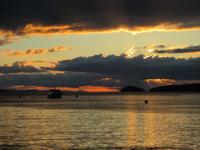
The Sunset and a Boat Passing Through the Channel Buoys. The buoy in the foreground is a mooring buoy.
Stats: TO – 19.67NM, MS – 6.9kt, MA – 2.7kt, TT – 7hr 25min, AD ~18ft, AS – 90ft
Misc.: Left a note for the owner of Pinguoin, the Flicka at FH; Lamb steaks and sunset for dinner; worked to get the right combination of small line on the top pintle and gudgeon of the rudder to keep it from “clunking” from the wave action at anchor; Engine time – 12min, idle only.

Friday Harbor could be considered the main port and epicenter of the San Juan Islands and this was where I was headed on day seven. NOAA Weather Radio was calling for a Small Craft Advisory with winds building from the south in the evening and it would provide adequate shelter. It is a hub for transportation, tourism and commerce and I also where my friend, Jenevieve, was spending the summer. I would get my first shower in a week whether I needed it or not and I would restock my provisions, in particular, fresh foods. I might even be able to top off my fuel tanks and water tanks, charge up my electronics, empty the garbage and rinse down the boat.
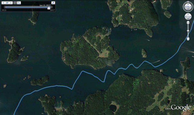
Wasp Passage
Having had a satisfying adventure in West Sound the day before I was ready to move on. I awoke and awaited the breeze to pick up. The wait was short and about 9am I weighed the hook and sailed out of the anchorage. The south wind continued to build and it was quick work to tack down the Sound with minimal current. We were at the bottom of the tide with the flood increasing as I approached Wasp Passage. This would mean I would have the current on my nose, but with the local geography, the wind was backing to the East and strong enough to carry me through, so I hoped. Wasp Passage is quite narrow and rock strewn, however the Washington State Ferry passes through here and its at least 100 times my size, so why shouldn’t I be able to do it? I decided it would be a good challenge. Inevitably, previously said ferry did come through, but while I was just beginning the traverse and I had room and time to move to the edge of the channel. I was fine with this, because if all went well, I would be through before another one arrived. I gybed back and forth through the channel as my boat does not like to run directly down wind. The main sail blocks the wind from the jib and the boat will de-power, which is undesirable as the jib will flop around noisily and I needed to keep the boat moving in order to push through the current. Half way through the pass there is a narrowing of the channel and the chart says “strong currents.” This would be the big test. Our progress was slowed but the aft wind held and once through we picked up both speed and room. I was expecting the wind to shift around to the nose at anytime as the aft wind was only so because of topography and I suspected that once we neared the western edge of Shaw Island, the island to our south, the southern wind would bend around its western corner and hit us head on. While this did happen, it happened later than I anticipated and I was in a good position to adjust to tacking and then it quickly backed around to the South as I exited the Pass. None too soon though, as Shirt Tail Reef, another of the SJI 10 most struck reefs was looming off to starboard.
Once in San Juan Channel I could breathe easier and able to make it down to Friday Harbor in three tacks going nearly hull speed. A Flicka 20, a heavy displacement boat, has a hull speed of about 6 knots, so thats as fast as I can hope to go, current aside. Current will either add to or subtract from that depending on favor. Yes, I travel everywhere at a jogger’s pace, at most. In reality it is usually more like a 3-3.5 knot average as hull speed is rarely achieved. Oh yeah, I also zig zag around and rarely get anywhere in a straight line. It’s really a wonder I get anywhere at all.

I entered the Harbor on the South side of Brown Island to check out the anchorage in Shipyard Cove. I stayed here back in May and liked the location as it had more of a “local” flavor away from the Port where the ferries, the seaplanes and the main visitors marina was located. I had moored here through 20 something mph winds in May that blow over the islands’ saddle but you don’t get any appreciable wave action. After sussing that, I changed my mind and decided to try the anchorage between Brown Island and the Port, just South of the WSF landing. My rationale was this would be closer to the services I needed. I was on my 3rd day without a motor and the building wind and current were teaming up and funneling between Brown Island and the Port. I sussed the limited room, the wind and currents, my stubbornness against starting the motor and I made my move.

Anchor Fail
Boy, did I suck on the main stage at the Port of Friday Harbor. Single-handing, I am manning the anchor and the helm, and inconveniently, these are on opposite ends of the boat. The water was deeper than I first figured, so when I let out the initial length of anchor rode, it was not enough. Actually, so “not enough” that I am not even convinced it hit the bottom. With the sails up for maximum windage and the current pushing me back, I was seriously adrift, quickly off my mark and crowding other boats. I hustled back up to the bow and let out more anchor rode. Phew, the anchor caught! Still, I was way off my intended spot and very close to another boat. I would need to pull the anchor up and either try again or reassess. Shoot! Time to start the motor and get safely out of this pickle. So I motored up and retrieved the anchor in front of the whole Port and anchorage. I knew I was being watched and I suppose I should have been embarrassed, but am not sure I was. Rather than be afraid to try, I gave it a go and ultimately did make it out unscathed. However, my heart was beating a few beats faster so to settle down, I cruised back over to Shipyard Cove and pondered whether to anchor or get a slip in the Port marina. There are major convenience factors for the slip, but I don’t want it to feel like defeat. Also, land and convenience are a “money suck” and I was having a great time without them. So I did the only rational thing, I flipped a coin. Heads, I anchor, tails, I get a slip. Tails it was, so off I go.
I stop and top off my fuel on the way. They have a new offering of ethanol free fuel. Score. Then I head over to the visitors moorage and as I pull in I see another Flicka 20 on the opposite side of the dock. Duh, so I take the slip across from her, of course. I get tied in and go about my business of tidying up, topping off my water tanks, rinsing the boat off, charging up the electronics, taking a shower, emptying the garbage, checking out the Flicka across the way and generally living it up in this $26.40 lap of luxury.
I have dinner with Jenevieve, check the wind speeds, which were in the low 20s, and plan the note I am going to write to the Flicka owner across the dock. It is a newer version and in great condition. I was admiring it earlier, taking pictures and comparing features and updates. I checked the serial number and it was the 3rd to last ever built. Dang! I wonder if they want to sell it?

Pingouin

Sampaguita and Tender
Stats: TO – 14.74NM, MS – 6.5kt, MA – 3kt, TT – 5hr 23min
Misc: OK, after a week, I probably did need a shower. Motor time – 30min.

On to West Sound, the middle inlet in the crab shaped Orcas Island in the faerie land of the San Juan Islands. A faerie land because the days have settled into the rhythm of cruising. We have shaken off the city and the routines of the 9 to 5, left the cars and trucks, the constant industrial and electrical dull roar of urban life, to the south. A dull roar you often forget you are experiencing until you try to sit quietly in peace or in the present case, achieve escape velocity into the cruising life. I am still left with the contemplation that without this drudgery I may not be having this voyage, but that is too defeatist to dwell on, as I consider the 17 days ahead and the unknown adventures I will have.
I awoke at my leisure and lit the propane burner for breakfast. I still have fresh milk for the hot tea and grapes for the oatmeal as my half-gallon milk jug ice blocks were faring well in the ice chest. Amusingly, I am reminded of the urban dull roar as I reflect on the walk-in freezer at the 9 to 5 which allowed me this luxury. This too shall pass, as ice melts as sure as the sun shines and my historic inclination to restock has never been strong. My diet and desires will change with the cruise, and what some will consider uncivilized suffering, I will consider simply as animal adaptation.
A review of the forecast on the VHF weather channel called for a light NW wind overnight, so West Sound would suit me fine. I prep for sailing in the usual way. I remove the sail covers, then the boom preventer which keeps the boom from wobbling around at anchor on my gallow free boat. I unhitched the straps which keep the halyards from slapping the mast, which keeps the peace at night, and make sure all of the halyards and sheets are clear to run. Since my distances are short and in protected waters, I keep the kayak inflated and will tow it from the starboard aft cleat, so I check that it is secure and the painter is short. Once under way I will lengthen the tow line if under sail, or keep it short if I am under motor. While the polypropylene painter will float, the danger of it getting wrapped around the propeller is still very real and diligence is always necessary to avoid this unfortunate, inconvenient and potentially hazardous predicament. I reset the portable GPS unit, a handheld Garmin device, so I can keep the days’ stats and I start a new entry in the log book. I don my life vest and after a moment of pause, checking the wind, which is light and from the south, and my surroundings; no strong currents, no nearby rocks and the other anchored boats are an adequate distance away, I decide with confidence that I will sail out of the anchorage. I uncleat the main sheet and hoist the main sail. I grab my gloves, move to the bow and pull off the two pieces of hose I have spiraled on the anchor rode for chafe protection. I pull in the line hand over hand and feed it into the hawser hole, removing any weed and mud and checking the line for wear as I go. I know my progress automatically as the rode markers pass by and I can feel the chain and then the anchor come off the bottom. When the chain leaves the sea floor I know to move with intent as we will be untethered soon and the boat adrift. There is no need to rush, but distraction and daydreaming is to be avoided and once the anchor is up on the bow platform, the business of securing it with the pin and then with a piece of small stuff to keep it from wobbling, is done with efficiency. Then it’s back to the cockpit to sheet in the main, haul up and trim the jib and set our course.
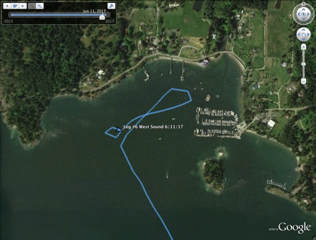
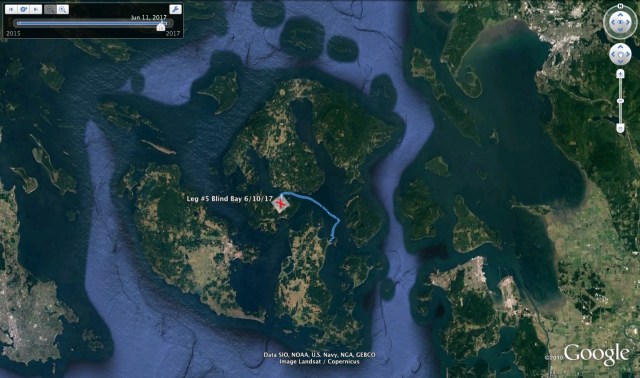
A light NE wind is present and it will get me from point A to point B without having to start the engine for a second day in a row. In leaving (and in entering) Blind Bay, I keep Blind Island to the west of me. There is a reef on the other side which is submerged at half tide and it is one of the ten most hit reefs in the San Juan Islands. Progress is slow for the first couple hours but the wind fills in as we get to the head of the sound. I sailed into White Beach Bay to reconnoiter the anchorage. There is a marina with fuel, The Orcas Island Yacht Club dock which if you have reciprocal moorage, I can highly recommend. I do not have such privileges on this visit but I stayed there two years ago. There is no fee, no electricity on the dock and no security but these are all easy to do without in this out-of-the-way hamlet. The OIYC has a clubhouse across the street, also with low security and showers and restrooms for guests. To boot, there is a county dock with free daytime moorage right next door to the OIYC, but there is no overnight moorage at this county dock. I opted for a night on the hook as that was a MO for this trip, settling in 40 ft of water with 160ft of scope.

As I sailed up West Sound, I saw a mountain looming above the bay. I decided that if it was possible I would like to hike to the top. Is it private land? Is is a park? I stopped by the West Sound Cafe which is just off the county dock and inquired. The host was very helpful and they had trail maps on hand. It turns out there is a “butt buster” of a trail, as she put it, which is accessible about 1.5 miles down the road. “This is a hitch friendly island” she said, but I was set on the exercise. The two lane highway to the trailhead has no shoulder and is well-traveled but I managed to survive both coming and going. The trailhead was easy to locate and the number of fearless deer I encountered was astounding. She wasn’t kidding about the “butt buster” trail and it was exactly what I had hoped for. My hike lasted 2-3 hours with great views from Overlook Peak and Ship Peak. You could view the San Juan Archipelago and beyond to the Olympic Peninsula in the States and Vancouver Island in Canada. On my return, I stopped by the West Sound Cafe to thank the host for the incredible recommendation, did some stretches on the dock as the sun set and headed back to the boat to settle in for the evening, glowing from a very satisfying shore excursion.
Overlook and Ship Peak from out on West Sound
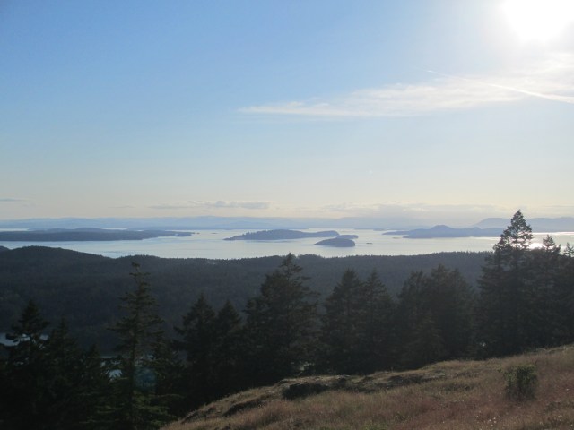
Looking West to the San Juans and Vancouver Island in the distance.

A view South down West Sound. In the foreground, to the right, just visible above the trees, Sampaguita lies to anchor. Blind Bay can be seen in the center left with several boats moored in it.
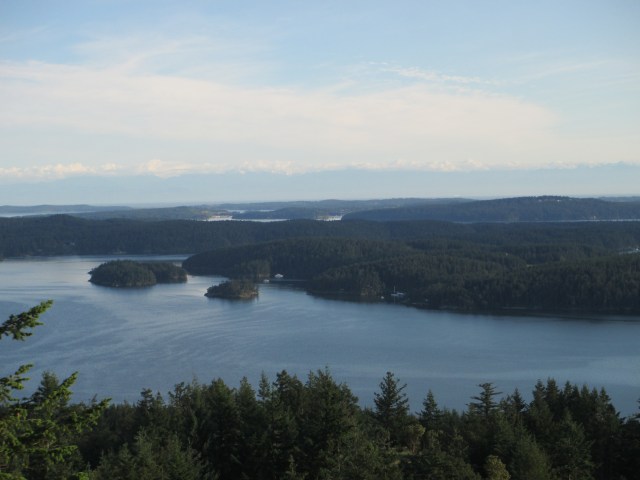
To the Southwest, West Sound in the foreground, the Port of Friday Harbor in the middle and clouds over the Olympic Mountains in the distance.
Stats – TO – 4.50NM, MS – 4.4kt, MA – 1.5kt, TT – 3hr 28min, AD – 40ft, AS – 160ft
Misc. – calm night, boat chores, good protection from a N wind, watch for seaweed on the bow roller as it may de-zinc the bronze
Day 5 began by doing the chores I meant to do in Port Townsend, such as gathering water, emptying the garbage, various boat tasks and exploring a bit. No Safeway, fuel, electricity or beer though, but they’re all overrated. It turns out Spencer Spit is one of the more popular marine parks. It was a Saturday and several boats came and went. There are several mooring buoys and also a slew of land based camping spots. Also, kayak rentals and guided tours.
I kept myself busy here until the mid-afternoon and then decided I would head over to Blind Bay, which is on the north side of Shaw Island. A moderate S wind had been blowing all day, but wouldn’t you know it, it let up once I was underway. I drifted and sailed in light wind until Harney Channel when the breeze filled in again. Then it was great sailing on a beam reach.
The rig was balanced, so there was no need to helm, and I was able to stand up on the cockpit seat with the breeze in my face. It was pretty awesome. This is what I am always striving for, but it requires consistent wind which is usually pretty rare. It gives me some relief from the helm and it’s fun in a physics geek sort of way. It is also difficult to achieve in anything from a broad reach to running point of sail. Some would say that a rig this balanced might be considered dangerous or inefficient. What if I fell overboard? Would it keep on sailing? Why don’t you use an autopilot? What about a windvane? Is the rudder working most efficiently and creating lift? Much of what helps this boat track well, is the full keel beneath her and the barn door rudder behind. The rest is good rig design. Good sail trim, which is on me, helps, but sloppy sail trim can be balanced too. To answer the questions:
- If I fell overboard, let’s remember that my boat is small. While I have been watching my weight with diet and exercise, I can still throw it around and use it to trim and steer the boat. If I fall overboard (because I’m standing on the cockpit seat with the wind in my face,) the boat will no longer be balanced and should round up into the wind and stall out….in theory. Let’s call that a small boat advantage.
- I don’t use an autopilot because a) if I fall overboard it won’t round up into the wind as previously mentioned and b) it takes electricity which I do not have an abundance of on the boat. I go from being a slave to the helm, to a slave of electricity. The first is simpler and cheaper, the second goes down a road of complication and expense.
- I have been studying windvane steering and it looks like the trim tab set up would be best for my boat. This will likely be a self built or custom built set up and we are not there yet. There is also some impracticality to using it for short stretches such as in Harney Channel. If we were on an ocean passage….bring it on. Oh yeah, this system will also leave me behind if I fall overboard.
- Coincidently, the large rudder sags a bit under its own weight when the boat heels over. Just about the 3 degrees you might want to create a little lift from the curve.
In the approach to Blind Bay, there are some rocks and an island that need to be negotiated and some tacking was in order as I was going straight into the wind. We lived to tell about it and I picked my spot and set the anchor. There were several boats on buoys as well as several at anchor, but it is quite spacious and well protected from the predicted south wind. I had been choosing my destinations and anchorages as per the weather forecast for the whole trip, letting that decide where I should be rather than a set agenda. A great aspect of today was that I did not need to start the motor at all. Sail it out, sail it in.

It was early evening when I arrived and below is an unchoreographed and candid photo of the “veranda.” Homemade blackberry wine, Josefina’s corn chips, hummus, carrots, grapes and other items I’ll let you guess about. The string hanging down is attached to the camera and I didn’t realize that was there when I took the photo. I never claimed to be good with a camera.
And below, a photo from the “veranda.” I thought I heard a live band playing when I was eating so afterwards I paddled the kayak out of the bay and across Harney Channel to the town of Orcas on Orcas Island. By the time I arrived, there was no band, it was dark and a much like a ghost town. Small town island living. I took a stroll and then paddled back with an incredible, rising full moon.
TO – 7.54NM, MS – 5.4kt, MA – 2.1kt, TT – 4hr, 3min, AD~30ft, AS – 130ft
Misc. – scrubbed rudder zinc, checked oil, exercised, sussed anchor line chafe


I woke up with the intentions of going ashore, provisioning at the Safeway, getting some fuel, charging some electronics(phone, computer, camera, VHF) and buying Bob some beer. But as I made tea, ate some breakfast, and did the dishes, the wind started to build from the South. Port Townsend seems to have its own microclimate which doesn’t correlate with any of the area weather forecasts, so especially as a non-local, it is difficult to predict what the conditions will be. A South wind puts you on a lee shore in a marginal, unprotected anchorage. A great town, a crappy anchorage. The wind was maybe 15-20kts which by itself is not a concern, however there is enough fetch to get significant wave action and a disadvantage of a small boat is these waves have a negative effect on your comfort, realized by a pitching motion. I could see some larger boats anchored nearby that clearly had a steadier motion. My anchor rode was taunt but the anchor was holding fine. I wasn’t sure if conditions would worsen, so I was hesitant to leave the boat and go ashore.
I stuck it out for a couple of hours, before I was fed up with the motion and decided I was “outta here.” I figured if I started the outboard in these conditions, it would ventilate in the wave motion until I could get the boat moving, however, an advantage of a small boat is that I find it pretty easy and safe to sail the boat in and out of anchorages. So, sail out of the anchorage is what I did, which is something I know owners of bigger boats would be hesitant to do. I relish it. Now the race was on to make it around Point Wilson before the ebb turned to flood. If I missed that window, I might have to retreat to Port Townsend. This is the entrance of Admiralty Inlet and most of the water that floods into Puget Sound comes through this entrance and the currents can be enough to halt a small boats’ progress. Comparing the advantages and disadvantages of small boats to big boats was a common subject of ponderance on this trip. Its cliche, but every boat is a compromise.
 I sailed out with one reef in the main and the working jib. Once confidently underway, I put a second reef in, only to be shaking it out by the time I was a couple miles out. That damn microclimate. Once I reached Point Wilson, the wind was essentially non-existent and I had to motor up as the tide was just turning. In fact, the Straight of Juan De Fuca was calm and I motor sailed the rest of the way to Spencer Spit. Some boaters would say that it was ideal Juan De Fuca crossing weather. I prefer some wind.
Here is a picture of Bird Rocks which are in the middle of Rosario Straight. These rocks have significance for me because one of the scariest moments of my boating career…so far… involved nearly hitting these rocks. To boot, my friend Kim was on board so I had the responsibility of someone else’s safety weighing on me.
It was 4 years ago and my first time crossing Rosario Straight and my first extended trip in Sampaguita. I didn’t expect the currents to be as strong as they were and due to this, my piloting was faulty. It was a windy day so I had the sails up, but also had the motor running to make the unknown crossing. The currents swept us down towards these rocks and I kept increasing the throttle on the engine, yet I could not seem to get the forward motion on the boat I needed. I also recall almost changing course at the last moment, as it was feeling desperate, which in hindsight, I think would have been a terrible idea. Ultimately, I believe what saved us was that the water current was forced around the rocks and carried us with it. I remember reaching back to ease off the throttle afterwards and realized it had been on full. We were all in. It’s also possible danger was not as close as it felt, but the experience and these rocks are firmly printed on my memory.
I arrived at Spencer Spit, a Washington State Marine Park, via Thatcher Pass that evening. Spencer Spit is on Lopez Island and I had reached the San Juan Archipelogo. I very much like that word. Rather than pick up a buoy, I opted to anchor. I chose the North side as the wind was predicted from the South. I have included a picture of the many sunsets I was to see as well as a picture of Sampaguita at anchor and a Washington State Ferry passing by.

TO – 31.89NM, MS – 8.1kts, MA – 4.2kts, TT – 7hr, 38min, AD?, Scope – ?
Misc. – 377min of motoring – ugh, – I now know I can pull the anchor up(no winch) by hand in 15-17kts of wind with a pitching boat, – Sailed in and out of PT anchorage


