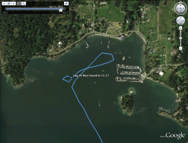
June on the Hook 2017 – Day 6 – West Sound

On to West Sound, the middle inlet in the crab shaped Orcas Island in the faerie land of the San Juan Islands. A faerie land because the days have settled into the rhythm of cruising. We have shaken off the city and the routines of the 9 to 5, left the cars and trucks, the constant industrial and electrical dull roar of urban life, to the south. A dull roar you often forget you are experiencing until you try to sit quietly in peace or in the present case, achieve escape velocity into the cruising life. I am still left with the contemplation that without this drudgery I may not be having this voyage, but that is too defeatist to dwell on, as I consider the 17 days ahead and the unknown adventures I will have.
I awoke at my leisure and lit the propane burner for breakfast. I still have fresh milk for the hot tea and grapes for the oatmeal as my half-gallon milk jug ice blocks were faring well in the ice chest. Amusingly, I am reminded of the urban dull roar as I reflect on the walk-in freezer at the 9 to 5 which allowed me this luxury. This too shall pass, as ice melts as sure as the sun shines and my historic inclination to restock has never been strong. My diet and desires will change with the cruise, and what some will consider uncivilized suffering, I will consider simply as animal adaptation.
A review of the forecast on the VHF weather channel called for a light NW wind overnight, so West Sound would suit me fine. I prep for sailing in the usual way. I remove the sail covers, then the boom preventer which keeps the boom from wobbling around at anchor on my gallow free boat. I unhitched the straps which keep the halyards from slapping the mast, which keeps the peace at night, and make sure all of the halyards and sheets are clear to run. Since my distances are short and in protected waters, I keep the kayak inflated and will tow it from the starboard aft cleat, so I check that it is secure and the painter is short. Once under way I will lengthen the tow line if under sail, or keep it short if I am under motor. While the polypropylene painter will float, the danger of it getting wrapped around the propeller is still very real and diligence is always necessary to avoid this unfortunate, inconvenient and potentially hazardous predicament. I reset the portable GPS unit, a handheld Garmin device, so I can keep the days’ stats and I start a new entry in the log book. I don my life vest and after a moment of pause, checking the wind, which is light and from the south, and my surroundings; no strong currents, no nearby rocks and the other anchored boats are an adequate distance away, I decide with confidence that I will sail out of the anchorage. I uncleat the main sheet and hoist the main sail. I grab my gloves, move to the bow and pull off the two pieces of hose I have spiraled on the anchor rode for chafe protection. I pull in the line hand over hand and feed it into the hawser hole, removing any weed and mud and checking the line for wear as I go. I know my progress automatically as the rode markers pass by and I can feel the chain and then the anchor come off the bottom. When the chain leaves the sea floor I know to move with intent as we will be untethered soon and the boat adrift. There is no need to rush, but distraction and daydreaming is to be avoided and once the anchor is up on the bow platform, the business of securing it with the pin and then with a piece of small stuff to keep it from wobbling, is done with efficiency. Then it’s back to the cockpit to sheet in the main, haul up and trim the jib and set our course.
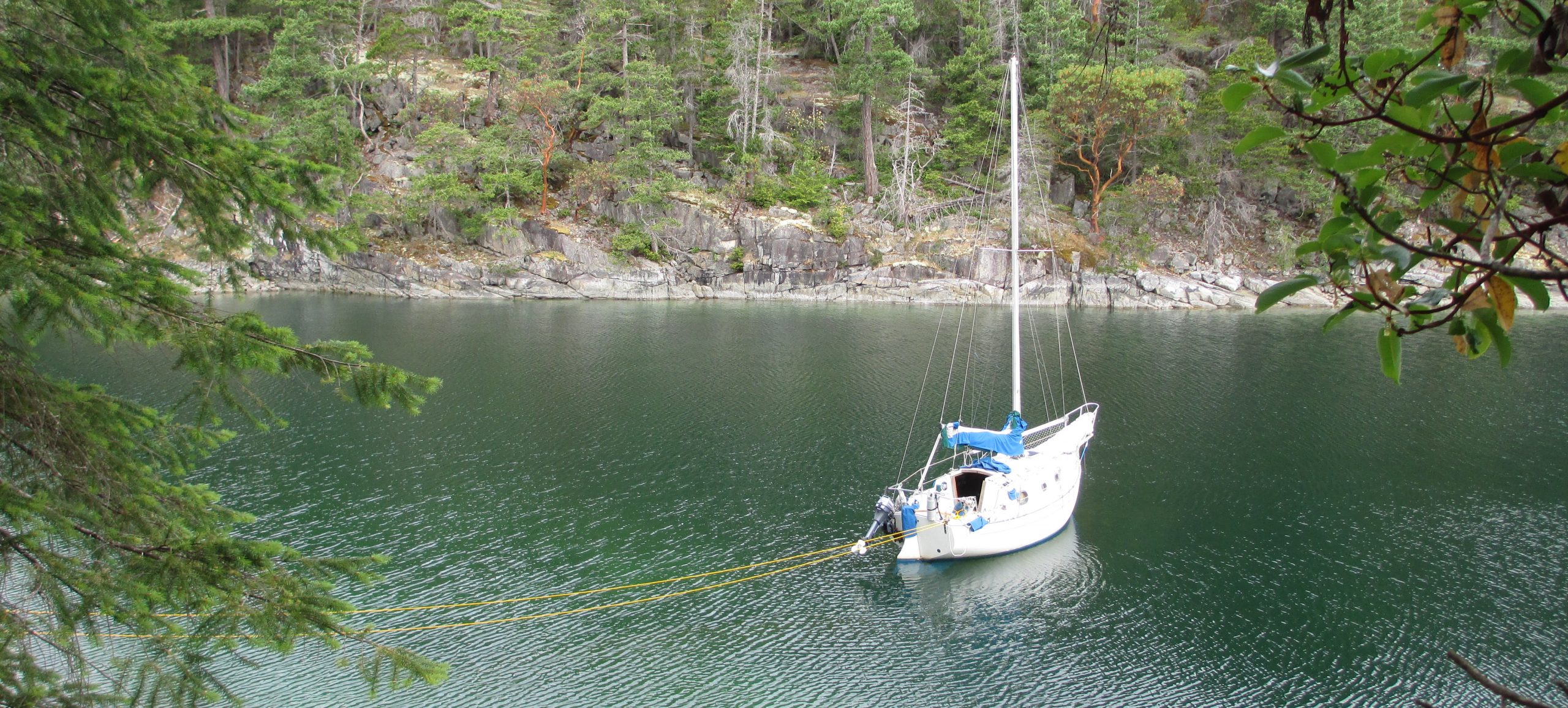
A light NE wind is present and it will get me from point A to point B without having to start the engine for a second day in a row. In leaving (and in entering) Blind Bay, I keep Blind Island to the west of me. There is a reef on the other side which is submerged at half tide and it is one of the ten most hit reefs in the San Juan Islands. Progress is slow for the first couple hours but the wind fills in as we get to the head of the sound. I sailed into White Beach Bay to reconnoiter the anchorage. There is a marina with fuel, The Orcas Island Yacht Club dock which if you have reciprocal moorage, I can highly recommend. I do not have such privileges on this visit but I stayed there two years ago. There is no fee, no electricity on the dock and no security but these are all easy to do without in this out-of-the-way hamlet. The OIYC has a clubhouse across the street, also with low security and showers and restrooms for guests. To boot, there is a county dock with free daytime moorage right next door to the OIYC, but there is no overnight moorage at this county dock. I opted for a night on the hook as that was a MO for this trip, settling in 40 ft of water with 160ft of scope.

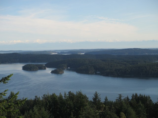
As I sailed up West Sound, I saw a mountain looming above the bay. I decided that if it was possible I would like to hike to the top. Is it private land? Is is a park? I stopped by the West Sound Cafe which is just off the county dock and inquired. The host was very helpful and they had trail maps on hand. It turns out there is a “butt buster” of a trail, as she put it, which is accessible about 1.5 miles down the road. “This is a hitch friendly island” she said, but I was set on the exercise. The two lane highway to the trailhead has no shoulder and is well-traveled but I managed to survive both coming and going. The trailhead was easy to locate and the number of fearless deer I encountered was astounding. She wasn’t kidding about the “butt buster” trail and it was exactly what I had hoped for. My hike lasted 2-3 hours with great views from Overlook Peak and Ship Peak. You could view the San Juan Archipelago and beyond to the Olympic Peninsula in the States and Vancouver Island in Canada. On my return, I stopped by the West Sound Cafe to thank the host for the incredible recommendation, did some stretches on the dock as the sun set and headed back to the boat to settle in for the evening, glowing from a very satisfying shore excursion.
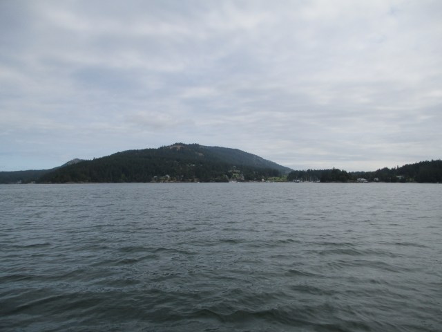
Overlook and Ship Peak from out on West Sound
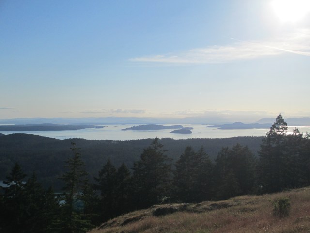
Looking West to the San Juans and Vancouver Island in the distance.

A view South down West Sound. In the foreground, to the right, just visible above the trees, Sampaguita lies to anchor. Blind Bay can be seen in the center left with several boats moored in it.
To the Southwest, West Sound in the foreground, the Port of Friday Harbor in the middle and clouds over the Olympic Mountains in the distance.
Stats – TO – 4.50NM, MS – 4.4kt, MA – 1.5kt, TT – 3hr 28min, AD – 40ft, AS – 160ft
Misc. – calm night, boat chores, good protection from a N wind, watch for seaweed on the bow roller as it may de-zinc the bronze
Discover more from Sailing With Josh
Subscribe to get the latest posts sent to your email.


