
The Last Age of Sail
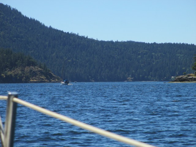
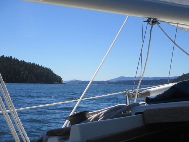
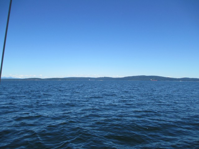
I awoke to a generous amount of wake as fishermen were coming and going from the Kingston Marina. No matter though, I was not interested in hanging out. I weighed anchor at 8:35am and with a light SE breeze and sailed from of the anchorage. I tacked out of the cove against the waning flood and sailed east toward Point Wells. The going was slow and 3 hrs later, just as I had reached the Point, the wind went calm. An ebb was on and so at 11:50, I turned on the outboard and made a bee line for Shilshole. In the good light of the morning I had checked my fuel level and was convinced I had much more than enough for the trip to Seattle. The day was very nice, the Sound was calm. I had made a good go of the sailing earlier, but it was obvious we were done with that for the day and the trip. It was a Wakesville day too, so my journey had a series of bouncy sessions. Wakesville is what I call a day when the wind is calm and the water is flat except for other boats’ wakes, which can at times, be quite substantial. Dependent on which direction they come from will determine whether it’s a roll, a yaw or a pitch.
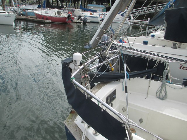
Blurry Eyed at Shilshole Channel

Circling at the Locks
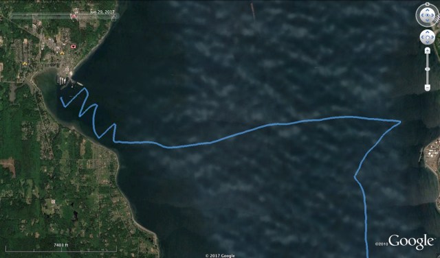
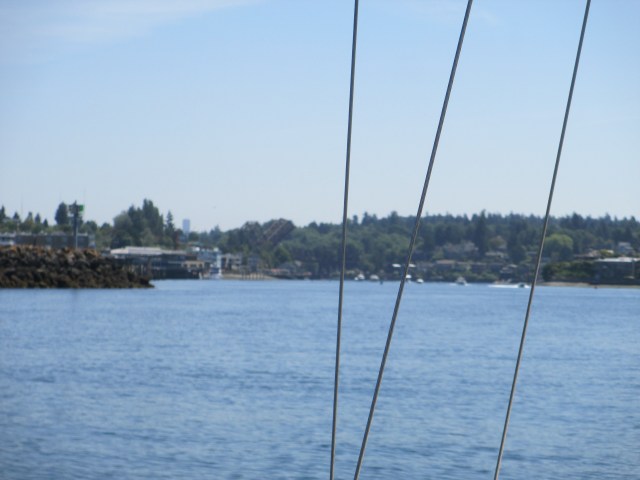
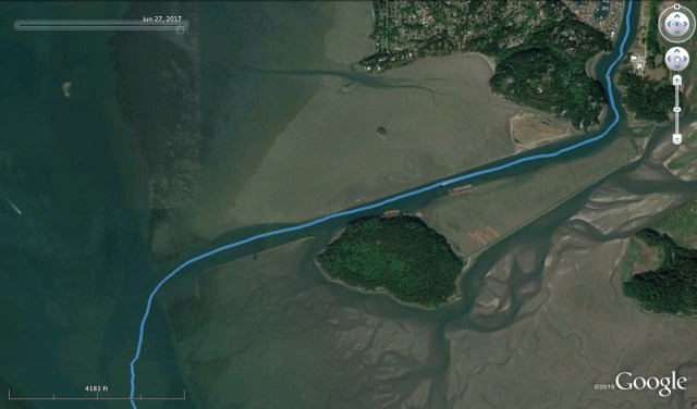
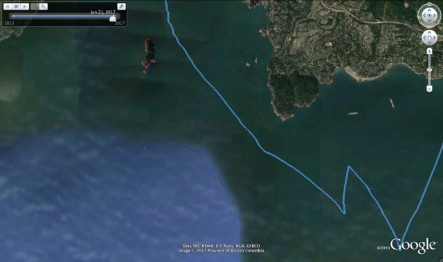
After a couple of hours of droning along, I reached Shilshole Channel and headed up to the small lock waiting area. On a Thursday before the 4th of July weekend, outbound traffic was heavy, while inbound traffic was light. I waited through two lock cycles as the Argosy tour boat had also arrived. Their transit took priority as they live higher up on the maritime locking through hierarchy. In the mean time, there was a small fishing boat coming and going and setting nets. A tug with a gravel barge also came through for the large lock, so I timed my circles accordingly. I was taken aback at how stressful it was to be in an urban waterworld with so many hazards around.
Alas, my turn arrived and I piloted through the locks uneventfully and on to my home slip in Ballard. It was 3pm and an undramatic ending to a great adventure. The boat was unkept as the last 3 days were more focused on home port fever than domestic chores. That would change over the next 2 days. I had plenty of time to do some tidying and cleaning now, adjusting to the home port life again.
This concludes an epic adventure and even more epic posting of the adventure. Thank you for stopping by and I hope you are also considering an adventure of your own.
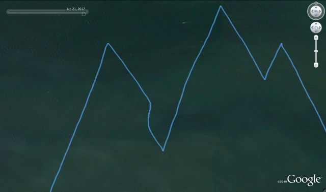
Stats: TO – 14.30NM, MS – 4.8kt, MA – 2.4kt, TT – 6hr, 57min, Motor on – 190min.
June on the Hook Summary
Departure – June 6th, 2017 Return – June 29th, 2017
20 evenings on the hook 3 evenings tied to a dock
19 days traveling 5 layover days
Total Expenditures – $218.33 (this only includes expenses incurred after departure and does not include preparatory expenses)
Moorage – $44.40 – 3 nights
Fuel – $27.86 – 3 top offs
Provisions – $48.95
Entertainment – $92.87
Showers./Misc. – $4.25
| Date | NM | minutes | minutes |
|
6/6/17 |
8.6 |
241 |
36 |
|
6/7/17 |
29.53 |
902 |
133 |
|
6/8/17 |
15.9 |
381 |
30 |
|
6/9/17 |
15.91 |
458 |
377 |
|
6/10/17 |
7.54 |
243 |
0 |
|
6/11/17 |
4.5 |
208 |
0 |
|
6/12/17 |
14.74 |
323 |
30 |
|
6/13/17 |
19.67 |
445 |
12 |
|
6/16/17 |
27.61 |
503 |
45 |
|
6/17/17 |
24.92 |
423 |
40 |
|
6/18/17 |
40.48 |
716 |
180 |
|
6/19/17 |
11.31 |
230 |
135 |
|
6/21/17 |
32.51 |
581 |
100 |
|
6/22/17 |
39.23 |
678 |
365 |
|
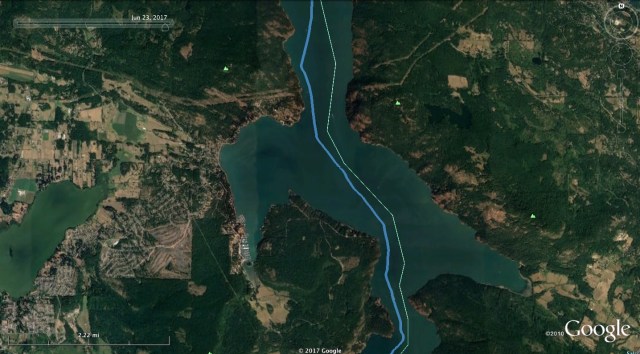
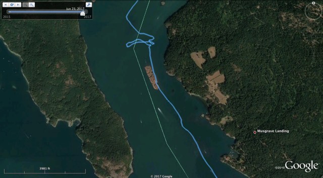
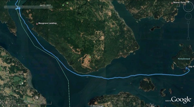
6/23/17 |
27.09 |
619 |
210 |
|
6/24/17 |
25.26 |
546 |
180 |
|
6/27/17 |
40.60 |
746 |
540 |
|
6/28/17 |
46.86 |
828 |
240 |
|
6/29/17 |
14.3 |
417 |
190 |
| Total |
446.56 |
9488 |
2843 |
| Avg./ travel day – 19 |
23.50 |
||
| Avg./ day – 24 |
18.61 |
||
| Hours traveled |
158.13 |
||
| % of travel time motor was on |
29.96% |
||
| Shortest Dist. in 1 day |
4.5 |
||
| Longest Dist. in 1 day |
46.86 |
||
| Avg. Speed – kts |
2.82 |

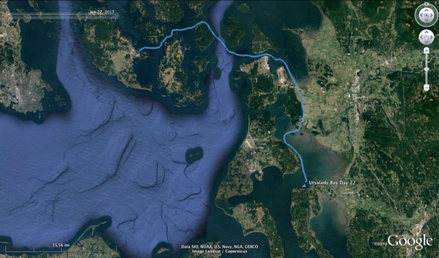
I sailed out of the Utsalady Bay anchorage at 9am with a light South wind and a waning flood tide. I sailed around the North end of Camano Island and beat my way down Saratoga Passage. The flood turned to ebb but the current was “weak and variable” in this area. Still, I made decent progress. As I approached Camano Island State Park, I got a lift from the wind as its direction seemed to veer to the SW. This may have been an effect of Holmes Sound tucked into Whidbey Island as it appeared to funnel from this direction. I was able to hold the starboard tack and sailed an arc which took me very close to the point at Camano Island SP. I was trying to make the most of it, all the time ready to tack over if it looked like I would run out of room or the wind decided to change direction or strength. I made the point and soon after the SW wind faded and shifted back to the South, which was right on the nose. It was light and variable and just enough to keep me moving in the ebb tide. I tacked back and forth, trying to make the most of it through the afternoon. Eventually, the tide turned to a flood and at 5:19pm, I started the motor.

Leaving Utsalady Bay

Looking Back at Utsalady Bay

A Good Beat Down Saratoga Passage

The Beat Slows Down
I was still thinking I could make it back to Ballard that evening, but my hopes faded quickly as I realized I was fighting a 1-2 knot tidal current in Possession Sound. I considered my options.
- First, I could go for Ballard. I would likely get there between midnight and 2am. I would still have to transit the locks, which are open 24/7, but I also was concerned that I could run out of gasoline. It can be difficult to judge how far you can go on a given amount of gas. I tend to think more in how many hours I can run, rather than how far I can go. Factors such as wind and tide can slow progress. Another significant determination is how many RPM you are running. The fuel used and the progress gained is not linear. As you approach hull speed, it takes more and more energy to eke out each fraction of a knot. Finally there is a point where, even though the engine will continue to increase RPM, get louder and use more fuel, the boat will not go any faster through the water. Hull speed for a full displacement boat such as mine can be determined by a the formula, HS = 1.34 x √LWL with LWL being the length of the boats water line in feet. My water line is 18’2” so my hull speed is about 5.7 knots. I find the sweet spot where I can balance fuel economy, engine volume and progress is about 4.3 knots through the water.
- Second, I could go to Everett which I have never sailed to. This would take me a bit off course and would also mean I would need to rent a slip, as I do not know of any anchorage in the Everett area.
- Third, I could go to Edmonds. This is on the way and they would have fuel in the morning, yet would require renting a slip, as there is no anchorage there. I have been to this marina before and in fact, Sampaguita was in this marina when I purchased her.
- Fourth, I could go to Appletree Cove at Kingston. Here I could get a slip or anchor out. I have never anchored here but I have read about it and I have seen it done often. If I needed fuel, I would be able to get this there in the morn. Appletree Cove is the farthest of the four choices, but the anchoring option was a big plus and it would be a fairly quick trip to get home the next day.
I decided on Appletree Cove. I motored and fought the current past Possession Point. I set the sails again on a WSW course in the light S wind, and in the open space of Puget Sound. Once past Scatchet Head, the flood tide on the nose, became a flood tide on the stern. This is because the tidal current floods through Admiralty Inlet into Puget Sound from the North, then fills into Possession Sound from the South.
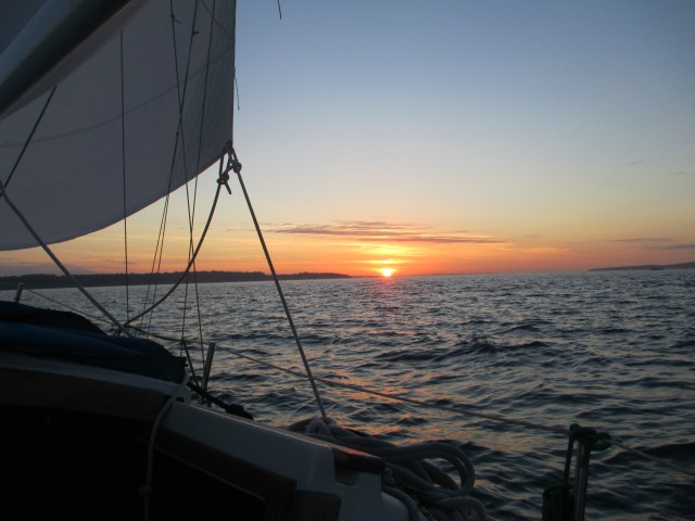
Sailing With the Sunset

Evening Push to Appletree Cove
I found myself running out of light for the second day in a row. The return legs from a trip always seem the hardest. The territory is familiar and the real exploring and fresh scenery is long gone. The urge for some might be to motor up and beeline to the home port (I call it home port fever,) making the return leg a chore to be done as quickly as possible. I could do this, if I was smart enough. Instead, I drag the trip out as I meander from beginning to end worshiping the sail. Still, I see the end goal and recognize my hard push to achieve it in my own way.
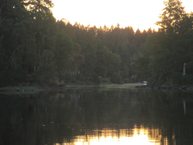
I found myself in the shipping channel with the waning light and in between two converging tugs. I turned on my navigation lights, turned the motor on and lowered the sails. I figured I could get to Appletree Cove in an hour if I didn’t hit any floating debris. I made it across the ferry lane and to the anchorage with the stars beginning to show. There were two fishing boats at anchor, the wind was calm and forecast to remain so. At 10:30pm, I dropped the hook in 40 foot of water and let out 130 foot of scope. The anchorage would be a bit rolly from the ferry and from boats coming and going from the marina, but manageable. I tidied the boat up, exhausted from a second long day, and crawled in to the berth.
Stats: TO – 46.86, MS – 6.1kt, MA 3.5kt, TT – 13hr 48min, AD – 40ft, AS – 140ft
Misc.: Motor on – 240mins, First time in Kingston anchorage
The long marine road to Seattle goes through La Conner. Did I know I was going to go that way when I left Friday Harbor? No. I had originally planned to go through Deception Pass and inside along the eastern edge of Whidbey Island for protection from the forecast Small Craft Advisory in the Strait of Juan de Fuca. The usual and shortest route to Seattle goes past Cattle Point at the southern entrance to San Juan Channel and across the Strait of Juan de Fuca to Port Townsend. I have taken the usual route several times but I was a bit leery with the weather forecast on the Strait. Normally this would sound fun, but not with a compromised shroud.
I weighed anchor from Shipyard Cove at 11am, which was a bit of a late start. With currents, timing is everything and this late start would determine my route. I was on an ebb tide and I headed east in the archipelago with moderate sailing winds. I had decided to take Peavine Pass which leads the way into Rosario Strait between Blakely Island to the South and Obstruction Island to the North. I chose Peavine Pass because I had never been through it before, and because it was closest. I hoped to get through it and into Rosario Strait while there was still an ebb tide so I could ride the current to Deception Pass.
I have only gone through Deception Pass once and that was headed west, so an eastward transit is on my list. It wouldn’t be this time though. As the day went on and the wind dissipated to nil, I turned the motor on at 1:42pm as I prepared for Peavine Pass. By the time I made it through Peavine, I only had about an hour of ebb tide left. The thought of slogging against the flood in Rosario Straight as far as Deception Pass, which was still 10 miles away, sounded dreadful and downright impractical. So I decided I would turn east into Guemes Channel and checkout Anacortes. This turn then put the flood on my stern and I started to make very good time, hitting speeds over 7 knots. With this boost I was inspired to keep on going and with Seattle as my goal, my only option was the Swinomish Channel, through La Conner.
The National Geographic “Quest”

Washington State Ferry in Dry Dock

Hoisting Supplies Aboard

Tankers and Tugs at the Refinery
Objects are Closer Than They Appear

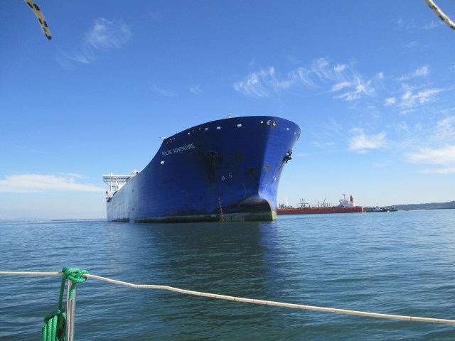
The Tesoro Anacortes Refinery at Padilla Bay
I continued on past Anacortes with its shipyards, its massive oil refinery/depot, it’s large vessel anchorage and carefully followed the channel buoys. The channel through Padilla Bay is surrounded by mudflats so it is imperative to stay in the channel. These mudflats are populated with many sea birds such as herons, grebes, eagles and Dunlins. This wildlife contrasts with the massive human industrial complex in and around the bay. I have been this way once before and while La Conner is an inviting little town, this route is not particularly inspiring. It generally requires motoring exclusively, the scenery is mostly industrial and drab, the waters are shoal and the tides can be difficult to read. It’s one major advantage, and this is a big one which makes it necessary and popular, especially amongst power boaters, is that it is an all-weather passage providing an inland and docile route around the Strait of Juan de Fuca with its potential for higher winds and the resultant sea state. This is why I was there.
I made good time and reached La Conner with a following tidal current the entire way. I very nearly pulled up to the city dock for the evening as it was getting late. There was a spot for me and the current was manageable. The tide turns the narrow channel into a river which changes direction four times a day. This can make docking and undocking a bit tricky, especially by oneself. The wind was very light, so I decided to forego the land trap and keep on as I thought I may be able to find a quiet anchorage in Skagit Bay. This was the original plan when I had originally considered Deception Pass.
Hole in the Wall to Skagit Bay
Well, as soon as I passed La Conner, the tidal current shifted to the bow. This was where the floods met and my progress suddenly slowed considerably. Determined to stay the course, I pushed on through Hole in the Wall which is just what it sounds like, a chasm where the channel cuts through a wall of rock. The channel makes a 90 degree turn to the West once you exit the wall and you are thrust out into the open of Skagit Bay. This hard turn creates eddies to negotiate and once through, there was a brisk West wind on the nose. I suspected this was the Small Craft Warning wind from the Strait of Juan de Fuca coming over the saddle of Whidbey Island. The channel here is straight and shoal, with a range set up on Whidbey Island to help guide you out. I was having regrets about not tying up to the La Conner dock and I suppose I could have turned back, but push on is what I did. The going was slow against the wind and the tide but I made it and turned South again once past the final buoy.
I raised the sails, but as I was closer to Whidbey Island now and away from the saddle, the wind had lost some of its spark and the tide was still adverse. Going was slow and I realized that I was running out of light. The anchorage I had imagined I would use, didn’t really exist. I pulled out the chart and studied it, trying to locate where a good place to anchor might be. I wanted to reach one before it got dark and I wanted one that would protect me from a West wind that could blow in off the Strait of Juan de Fuca. Penn Cove was too far. So was Oak Harbor and it has a tricky entrance I have only done once, several years ago. The guide books had nothing for this area either. I settled on Utsalady Bay on the northern edge of Camano Island. It looked like I could tuck in behind Utsalady Point in about three fathoms of water with a mud bottom. It was a high tide so the approach would be fine. I could see where I wanted to go, but it was still about five miles away. That would be over an hour by motor and I was cutting it close as far as light was concerned. I motored up and went for it.

The Improv Anchorage
I arrived at Utsalady Point and I decided it would do. It was just beyond dusk. There was a mooring field there with several pleasure craft so I dropped the hook on the outer edge of this field. It might get a little rolly, but would do just fine and by the time the anchor was set, the other boats were just silhouettes against the street lights and television sets ashore. By the time I had tidied up the boat and grabbed something to eat it was midnight. It was a long day and it was debatable that I had made a good decision by not stopping in La Conner. On one hand, I passed up an inexpensive city dock in a quaint little town and pitted myself against the elements of adverse current and wind without having a well researched anchorage plan. On the other hand it appears to have worked out and the anchorage was suitable in the present weather. To boot, this was the first anchorage I have used that I had not been guided to by a book. Up until now, I had played it safe and followed those who had gone before me and have been clever enough to publish books about it.
Stats.: 40.6NM, MS – 7.6kts, MA – 3.5kts, TT – 12hrs 26mins., AD – ~28ft, AS – 130ft
Misc.: Unpublished anchorage, 550mins. motoring, debatable planning.

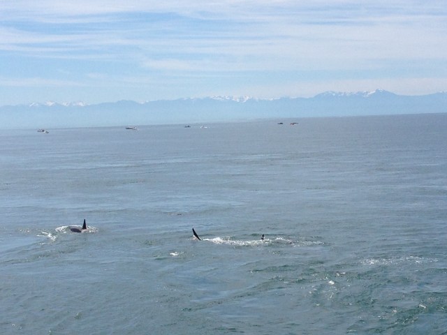
Southern Resident Orcas Sighting Off of Lime Kiln State Park, June 25th 2017
One of the great things about exploring the Pacific Northwest from a small boat is the marine wildlife that I experience. I observe orcas, humpback and grey whales, sea lions, sea otters, Dahl’s porpoise, harbor porpoise, salmon, cormorants, eagles and kingfishers to name only a few. My encounters with marine wildlife have typically been by chance. When I am on the water, my attention is often focused on the wind, the currents, the boat, my schedule, what will I eat, am I keeping myself hydrated and a number of other self-absorbed thoughts. I look out over the surface and often see a barren landscape. Then, often suddenly, marine wildlife breaches the surface and I am reminded of the activity, diversity and biomass that begins just below the surface.
Whales are the marine life that piques most people’s interest and are typically the rarest. Still, I have come to expect a couple sightings per year. In 2017, I watched a humpback off of Apple Cove Point near Kingston for 45 minutes. It was diving in the tide ripped waters while I drifted on a windless June day in the Flicka. In previous years I have seen humpback and grey whales in the Strait of Juan de Fuca and along the West coast of Vancouver Island. These massive animals surfacing and breaching a stones throw away are larger than the Flicka and heighten the experience with a level of fright. Once, when I was circumnavigating Vashon Island in Puget Sound in my canoe, a humpback surfaced 50 feet away. Startling, alarming and amazing to say the least. “Wow, it’s awesome to see you, now please swim away.”
While technically dolphins, I have witnessed southern resident orca pods off of Kingston, Blake Island, and San Juan Island. I have spotted transient orca, in Spieden Channel, in Port Jervis Inlet and in Puget Sound. Transients can be identified by their small groups or solo appearance. The mother of all sightings was not actually from my boat, but from Lime Kiln Sate Park on San Juan Island, which I was visiting on my June 2017 sailing trip (so I was still exploring in my small boat.) It was remarkable. We watched the J and K pods go by in Haro Strait for 15-20 minutes on a beautiful day and several were only about 100 yards off shore.

The Lime of Whale Watching Boats in the Distance
There are laws designed to protect the marine wildlife and set parameters for viewing.
The Parade……

……Goes On……

…… And On……

Mama and Babe


Red Skies at Night

A Barbecue and Sunset from San Juan County Park

Looking South Over Haro Strait

June 25th, Whales, Barbecues and a Skiff Ride to Canoe Cove on Lopez Island
June 26th, List of Chores Completed:
Kayak to get Fuel, Empty Trash, Do Dishes, Charge Phone, Call John Van Lund for Flicka Tour, Tidy Boat, Prep to Leave on Tuesday, Check Rigging, Book July 4th Trip to Sidney, Fix Back-Up Headlamp, Retrieve Flashlight from JC, Suss Solar Lamp – Battery?, Check Bilge, Check Anchor and Suss New Boat to Anchorage, Tighten Halyards.

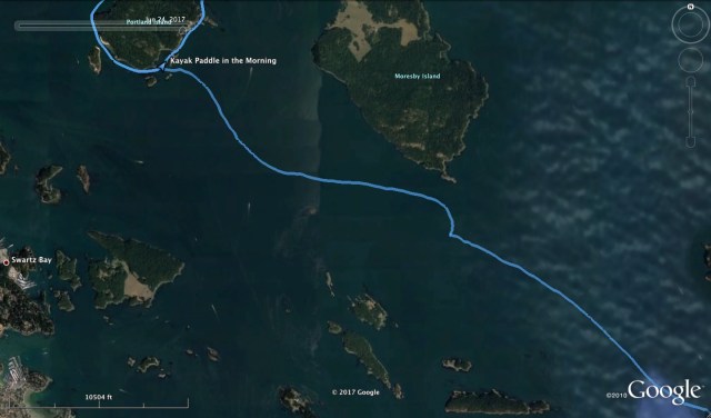
I awoke at sunrise and prepared to paddle the kayak around Portland Island. It would be good exercise and a way to use time before the 9am low tide, when I was going to attempt a retrieval of the anchor rode chafe guard I dropped overboard the previous day. I saw a neighboring boater returning from a similar exploit, but with a hard shell kayak. I would make a counterclockwise circumnavigation with the hope I would get some favorable tide on the way back.
Sunrise in Princess Bay

Kayaking Around Portland Island. Of note are the reefs on the NE side.
The waters around the island are reef strewn and the current flows dramatically through these reefs. This makes them unpredictable. There was also a challenge to stay in water that was deep enough for the kayak. While the kayak only needs a few inches of water depth, the paddles need considerably more. The reefs are a bit jagged, so keeping the PVC inflatable off of these was a priority. It was a great work out physically and mentally to weave through the reefs and currents, especially along the northeast side of the island.

Kayaks and Campers

Mmmm, Wood Chips

Looking North

Looking North, Zoomed In. The mountains in the distance are mainland BC.
When I got to the northern most point, I pulled ashore onto a beach just east of Royal Cove. I took some photos and used the outhouse. The outhouse was the nicest smelling outhouse I have ever been in. In true Canadian style of practicality and simplicity, they had a composting toilet with a box of fresh-cut wood chips to the side that you sprinkled on your business when you are done. The dominant aroma was this box of wood chips. If only all outhouses could smell this nice. I suspect that this island is easy to service by the parks department due to its proximity to Sidney and this style outhouse is not yet a norm in all Canadian parks. There were also some campers in this cove as there was an official campsite located here. These folks had travelled in by kayak which is a very common mode of exploration in both the Canadian Gulf Islands and the American San Juan Islands.
I continued on around to the west of the island. I arrived back to Princess Bay in time to plan my attempt at retrieving the chafe guard. I dd not know exactly where I had dropped it but I knew it was likely within a 50 foot radius of the boat. I was going to use the kayak and paddle the bay in a grid pattern. I started with my best guess and quickly located it. The water was clear and shallow at this time and the white piece of hose contrasted well enough against the mud bottom. I used the leadline with a fender buoy to mark the spot, which at first worked well enough. However, the hose wasn’t far from where the boat was and the breeze and current kept swinging the boat around at anchor and into my buoy. This wanted to drag it off the mark and the line eventually got caught between the rudder and keel. For a chafe guard retrieval tool, I took a jib pole and extended it out and then duct taped an extended boat hook to this. Now I had one 14 foot long rigid pole. A big challenge was keeping the kayak in the correct spot. Any force, be it wind, current, or movement of the pole through the water, wanted to push me off target. Another challenge was to correctly judge where the hose was and not be fooled by the water’s refraction. I found that the poles also needed to fill with water for without this, they had too much buoyancy. After about seven tries, I was able to snag the hose and I brought it to the surface with a sense of achievement. Next, was to use the same pole to unsnag the leadline from the rudder and finally to drain the poles of the water. The plan and procedure worked about as good as I could hope for and I had the satisfaction of not littering, not losing the boats gear and successfully creating and completing a rescue operation. To boot, I gave the elderly couple in the boat next to me a chance to “anchor gaze” while I was at it. “What is he doing over there?”
Losing the Wind

Leaving Princess Bay

Battling the Tide

Sailing Toward Friday Harbor
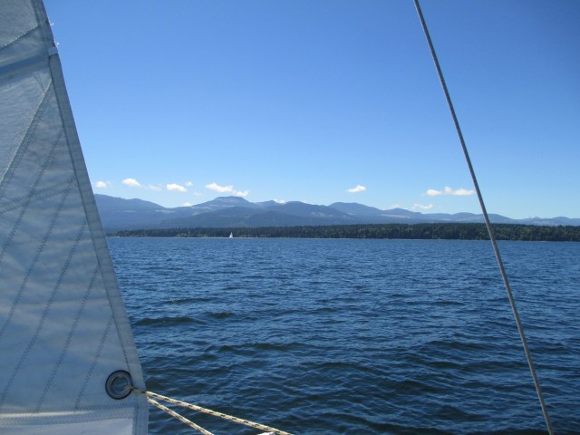
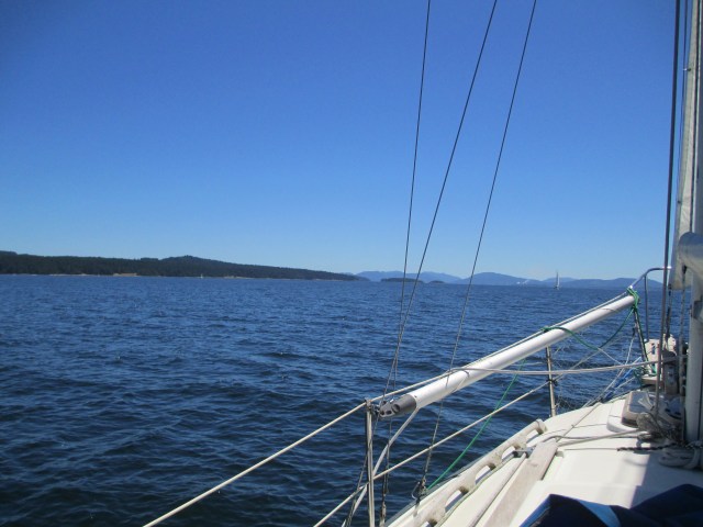
I prepped to leave in hopes that I could play the current into the San Juan Islands. I weighed anchor at 10:30am and motored out of Princess Bay. I quickly got the main and jib up and shut the motor down at 10:38am. I had a brief sail until the wind faded at the Canadian edge of Haro Strait. I started the motor and continued across the Strait. Haro Strait is the main channel for tidal flow in and out of the Canadian Gulf Islands. It is the Strait that separates the American San Juan Islands from the Canadian Gulf Islands, this border established by the resolution of The Pig War. I had some favorable tide here that had me moving up to 7.2 knots, but once across and headed into Spieden Channel the current was against me and slowed me to about 1-2 knots. I have had these adverse currents headed in this direction of Spieden Channel before. I have not figured out what the optimum transit time is relative to the tides. I ground it out and made a play for the inside channel between Spieden Island and Sentinel Island in hopes to get relief from the current. A bit earlier, I saw the Washington State Ferry take this route. I suspect they either did it for relief from the tide or to get closer to Spieden Island in hopes to view some of the exotic wildlife that was transplanted there in the 1970s in a now defunct, private, big game hunting resort. This strategy seemed to work and the farther I went, the more favorable the tides became. I finally picked up the full flood on the northeast side of San Juan Island and down to Friday Harbor. I was also able to do some sailing here with a NW wind of about 10 knots.
The Customs Dock and Friday Harbor
I was required to check in with U.S. Customs when I landed for the first time in the U.S., returning from Canada. I went to the clearance dock they have designated for this at the Port of Friday Harbor. I landed and went to the phone provided and called Customs. I spoke to an officer and he asked the standard questions. What was my nationality? Where was I coming from? How long had I been there? Do I have anything to declare? When satisfied, he said I could go to my slip, but then I needed to come up to the offices on Spring Street and verify the information. I explained that I would be anchoring out. He said I should leave the boat at the clearance dock and come up now. So I grabbed my ID and my boat’s papers, which is a fancy way of saying my registration. Truthfully, there are other documents included in the portfolio of “boat’s papers,” but the registration was all I would need. When I arrived I was met by an officer who asked, “Sampaguita?” I said yes, he said, “Like the National Flower of the Philippines?” I said yes ,“I am from the Philippines” he said and went on to thank me for coming up to Spring Street as they were presently short-staffed.
He checked my ID and my boats papers and that was that. Sampaguita is under 30 foot in length, so there is no fee for re-entering the U.S. as there is for boats over 30 feet. This is a small boat advantage. I bounded out the door and back to the clearance dock as I was interested in getting anchored and settled in, sooner than later. It was a week since my last shower, so I wanted to get that done too. There was quite a bit of bustle going on in the Port and the tall ships, the Hawaiian Chieftain and the Lady Washington were in the harbor. The Lady Washington has world fame as being one of the ships they used in filming the Pirates of the Caribbean: The Curse of the Black Pearl. They were giving tours and getting ready for some sort of “pirate re-enactment” with mock battles out in the channel. Amusing, but not for me.
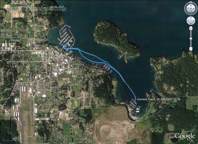
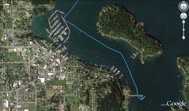
I sailed off of the customs dock and headed over to Shipyards Cove where I like to anchor. I anchored here for 4 nights in May and it suited me fine to be a bit away from “downtown.” I could paddle into the Port or over to Shipyard Marina. I had friends who used the latter and I could meet them there.

Anchoring in Shipyard Cove
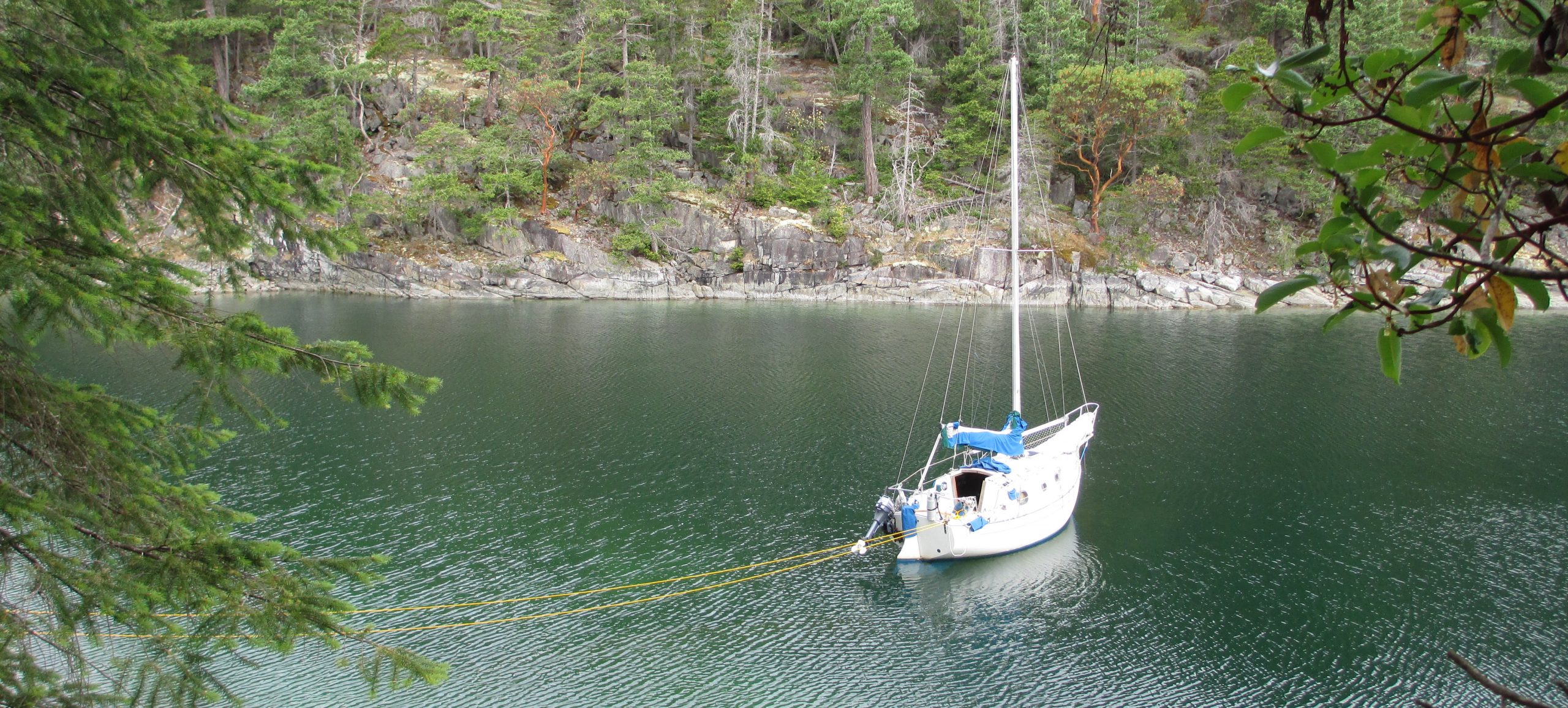
I re-anchored once as I didn’t like my first attempts proximity to an empty, permanent buoy. Once set, I checked the depths at 40 feet and I let out 145 feet of scope. The anchorage was empty and I set to work tidying up the boat, putting on chafe guards and gathering my trash to take ashore. I was planning on being here for a couple of days, so I was making the boat comfortable.
I touched base with my friend Jenevieve to meet about 7pm. She had a skiff at Shipyard Marina and she would come out to the Flicka. This would give me time for a shower and snack. When she arrived, we decided to take the skiff to Turn Island State Park which is just east of Friday Harbor with the highlight being a deer swimming across Boat Channel from San Juan Island to Turn Island. I was very impressed and wished I had gotten a picture of the deer. Then we took the skiff over to the Port and tied up at the Dinghy Dock and went and got some food and drinks. Boats are fun.
Stats: (This included kayaking around Portland Island) TO – 25.26NM, MS – 7.2kts, MA 3.1kts, TT – 9hr, 6mins, AD 40ft, AS – 145ft
Misc.: Motor – 168mins.

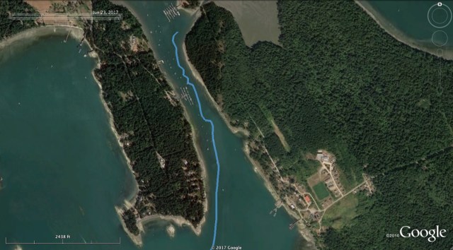
I made another early start from Telegraph Harbor. My plan was to catch the ebb tide down through Sansum Narrows, on the west side of Salt Spring Island. In combination with a north breeze, this should get me down to the Southern Gulf Islands and possibly to the San Juans. I had never been through Samsun Narrows and I felt like it could be a shortcut with favorable tidal currents of 3 knots. Making it to the San Juans was a lofty goal that would depend on optimum sailing conditions and a motor. Going through customs and anchoring need to be considered too.
The Comic Drift
At 5:30am, I weighed the anchor in Telegraph Harbor and started my drift out. I say drift because the sun was up but the wind was not. I had the main and jib raised and the only draw I was getting in the sails was from the air flow caused by my fraction of a knot drift. I tacked a few times and gybed once to stay in the narrow channel and avoid buoyed boats. The scene was kind of ridiculous, but the idea of starting the motor on the quiet and peaceful morning was unappealing too. I stubbornly held out for the breeze that I was sure was going to set in anytime from the north.
Waiting it Out
I worked the sails for any air movement I could harness to get into Stuart Channel. I was putting quite a bit of effort into getting the most out of the light and variable winds and getting little reward. So I boiled some eggs, I ate some salad, I drank some tea and watch the world (at least Canada) go buy at a snail’s pace. I still had the ebb tide but that was not going to last beyond noon. At this rate I was not going to make the San Juans and I was beginning to doubt I would even make it through Sansum Narrows.
Sailing Through Sansum Narrows
Finally about 10am the N wind filled in. Maybe 10 knots? This was enough to set me on my way. I wanted to put the genoa up, but decided against it with the uncertain shroud. I would have to settle with the main and the working jib. The narrowest part of Samsun Narrows is brief, but the full channel as it winds through the gap between Salt Spring Island and Vancouver Island is several miles (nautical? kilometers?) long. This results in elevated tidal currents along its length which can be a 1-4 knot boost over the distance. Of course, it can be a 1-4 knots against too. The four and a half hours lost waiting for the wind to appear would prove to be significant. I will confess that had I turned the motor on in the beginning and taken full advantage of the tidal cycle, I would have likely arrived at Portland Island having run the motor less time than I eventually did. The motor is such a bore to me that I make these choices.

Baynes Peak, Sansum Narrows

Looking North
The Narrow Bit
But for now, I still had a favorable tide and wind so I wished myself along as fast as possible. I gybed my way through the channel with the good following wind which was winding through the channel too. I heard the rig creak a few times and this got my attention, but kept on. As I approached the narrow part of the channel, the swirling currents kept me on my guard. I mentally went through the steps of lowering the motor and getting it started. The whirlpools wanted to set me toward the rocks or the shore and it was difficult to tell which way the current was truly flowing. The wind was still pushing me south and out of the swirling clutches of current, but my progress was slowing and I could see that the wind was diminishing the farther down the strait I went.

Looking Back Through the Narrows. Tide Rips to the Right.
Looking South, Almost Through.
Where the Wind Ends
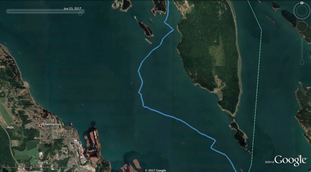
I thought I was going to be able to sail all the way through the channel, but alas, it was not to be. The wind became light and the current adverse. I gybed back and forth a few times to see if I could work my way through, but while the flood tide was picking up, the wind was not. I gave in and started the motor. It was about 12:40pm and I escaped the grips of the Narrows, but had an afternoon of heading straight into a 1-2 knot flood tide with plenty of sunshine, but no wind. This is Satellite Channel that feeds Saanish Inlet and the Sansum Narrows and I could see that with a following tide, one could make great progress and, at least under motor, and easily make the trip to or from the northern gulf islands in a day.
Satellite Channel and Against the Tide
I spent the next three and a half hours motoring against the tide to Princess Bay on Portland Island. Portland Island is part of the Gulf Islands National Park Reserve and I arrived to a nearly full anchorage. I thought one boat was leaving, but they were just reanchoring. I was faked out by another boat starting its motor, but maybe to charge its batteries. I finally found a spot that I was satisfied with and I dropped the hook in 18 ft of water at about mid tide. In the process of grabbing my leadline to check the depth, I knocked the anchor rode chafe guard into the bay. It is just a spiral cut piece of hose, so nothing fancy and I had extra hose to make a replacement. However, I didn’t like the idea that I had just lost plastic tubing into the Park Reserve and if the chafe guard had been returned to its proper storage place, it would not have fallen in.

Portland Island

Princess Bay from Satellite
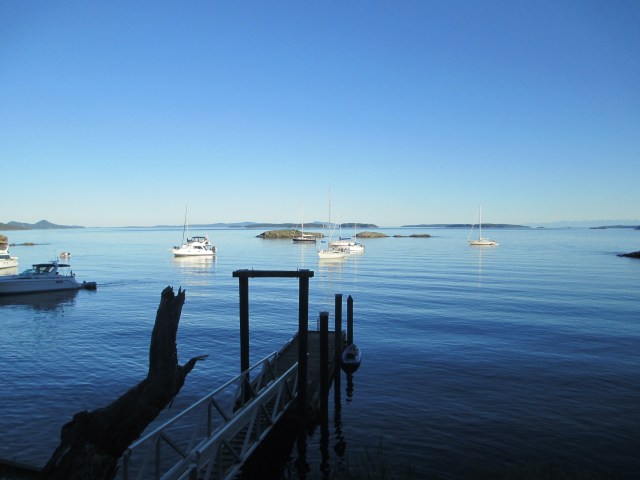
Princess Bay From the Dinghy Dock. Sampaguita is in the Center. The Kayak is at the Dock.
I tidied up the boat, made a new chafe guard and thought it through. With water levels at 18 feet and rising, I could not really see the bottom of the bay, but tomorrow at about 9am the tide will be low and the water level should be around 12 feet. Maybe I can formulate a plan of retrieval for that time. If conditions permit, I will be able to see the bottom, locate the hose and have the correct sized tools to fish it out.
A few more boats entered the anchorage and found spots either on the fringes or stern tied to the shore. While I ways happy with how I was set, I saw a bit of reanchoring going on and anchors coming up with lots of weeds on them. I inflated the kayak for the first time since False Creek and headed ashore. There is a dinghy/ranger dock in the bay and there are well-marked trails intersecting the Island. The island has a long and interesting history of being inhabited, evident by the 3000-year-old midden beach and the more recent 100-year-old orchard planted by Hawaiians.
After a couple of loops and 2-3 miles I headed back to the dinghy and the Flicka. I ate dinner and did some reading. The night was beautiful and you could see the bioluminescence in the bay when you disturbed the water. The clear skies meant the stars and the Milky Way were in full view. This was my last night in Canada for this trip. I was moving forward and would head to Friday Harbor to regroup.
Stats: TO – 27.09NM, MS – 5.6kt, MA – 2.6kt, TT – 10hr, 44min, AD ~ 18ft, AS – 75ft.
Misc.: Motor time – 210min., some mosquitos, anchorage so-so, trails are good and the Island is interesting, popular as it is a quick overnight/day trip from Sidney.

Crossing the Strait of Georgia became my main prerogative, so I decided to wake up early and see if there was a weather window. I had an interest in crossing in more settled weather with the uncertainty of the shroud. This was a bit of an attitude change. I couldn’t ignore the Strait. Thermals can build in the afternoon to 20 and 30 knots. It was the June Frazier River freshet after a high precipitation winter and there was debris in the water. A window early in the morning would be the best bet and sooner rather than later. I was on the back half of my trip and if strong winds rolled in, I could be trapped on the east side.
I woke for the 4am Environment Canada update. Environment Canada is the Canadian version of NOAA Weather Radio that broadcasts on the VHF weather channels. The forecast agreed with crossing if I left immediately. It would likely be a 6 hour crossing, with the expectation I would motor most of the way. The predictions of days ahead were of less optimum conditions so I decided to hit it. I started the motor at 4:53am.
I left Snug Cove, following Queen Charlotte Channel to the Strait of Georgia. Winds were light in the beginning with moderate seas, though beamish. I raised the main with one reef and we made good time, but both the wind and seas increased over the next few hours. Our relation to the wind was good for the main sail, but the beamish wave angle as per my heading were making the boat roll. More so as the waves increased. My heading was 240 degrees magnetic toward Silva Bay, or at least I hoped. The Strait is just large enough to challenge my pilotage on several occasions. There is often a haze and the distance is such that the curve of the earth plays a role and you can’t actually see the opposite shoreline, most of which I have little recognition of anyway.

The Approach to Gabriola Passage
As the seas increased, I felt a need to change my heading more to the south. I cracked off to about 220 degrees magnetic. There was an ebb tide and a NW wind putting our current and wind in agreement and that was good, though increasing our southing. This extra southing started about halfway across. This caused me to miss Silva Bay and by the time I knew where I was, it would have meant heading up wind, against the current to make good. This had little going for it. The location tip-off was the Thrasher Rock Marker which is part of the Gabriola Reef, south of where I wanted to enter Silva Bay. This was a point of anxiety though not an unfamiliar one. I was never certain of my position the entire crossing until I recognized and comprehended Thrasher Rock. I was practicing steering by magnetic heading and I was unfamiliar with the look of the land.
I experienced this area on the outward leg and I accepted that this was my new approach. With effort and time, I located all of my markers and buoys and used the handheld GPS to help tune my approach. My reasoning came up with two options. Option one would be to try to make it through Gabriola Passage in time to beat the tide or to approach Silva Bay from the protected waters to its south. I decided the first with the second as the back up plan.

Gabriola Passage
I knew I was not going to catch the tide through the passage, so it was all about getting through before the current became so strong as to stop forward motion. It looked like I could make it within the first hour. Maybe. The flood tide moves north through the Gulf Islands into the Strait of Georgia. So a flood tide in Gabriola Passage was flowing into the Strait and against the Flicka’s direction. This slowed my progress and by the time I got to the bottle neck I had the throttle wide open on the outboard and we made about .5 – 1 knot over ground. That puts the current at 5 knots. Once beyond the bottle neck we increased speed and I believed we would make it. If you recall my outward leg, there is a log boom area just inside the pass in Pylades Channel. I was just entering the Channel from the Passage when to my alarm there was a deadhead about 8 ft to my port beam, floating one foot below the surface of the murky water. If in my path, I would never have seen the deadhead before striking it. It was 10:30am.

Gybing Down the Gulf Islands.
Looking West. The Main is Double Reefed. Vancouver Island in the Distance.
Looking South. Protected Gulf Island Waters. Thetis Island to the Left. In the Far Distance, Vancouver Island and the Catalyst Paper Corporation Papermill.
Looking East. The Mountains in the Distant Far Left is the Canadian Mainland. The Island Behind the Anchored Ships in Trincomali Channel, is Valdez Island.
The day had blossomed into sunshine and I had made it across the Strait and was safely inside the Gulf Islands. At 10:58am I turned the motor off after 6 hours of the dull roar. I then had a good following breeze from the NW, so I gybed my way through the islands. I kept the main sail double reefed until I reached the entrance to Telegraph Harbor. The sheltered waters of the Gulf Islands put me at ease with the rig and I felt I needed to get my mojo back.
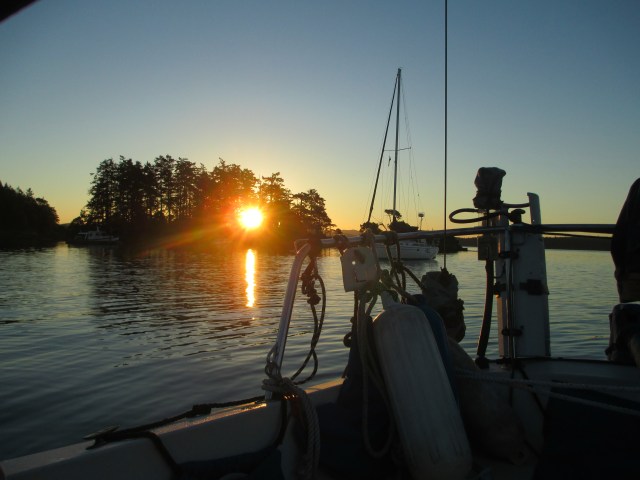
My final approaches to Telegraph Harbor had me threading the needle through the rocks and dodging the ferry. I had shaken out the reefs and was using the flooding tide. I finally got tucked into the harbor and dropped the anchor. It’s a tight spot because there are many boats on buoys, shallow depths and there was one other boat anchored when I arrived. I found a good spot off the south end of the Telegraph Harbor Marina with enough room to swing and great shelter from any wind and waves.
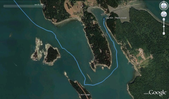
Approaching Telegraph Harbor.
It was about 5:30pm by the time I had the boat tidied up for the evening. I made a salad from the Granville Market produce, read One Island, One Ocean, about the Around the Americas trip and fell asleep early. I woke up in the middle of the night to check the anchor and the lay of the boats. The view of the stars and universe was amazing.
Anchored, Looking East at The Cut.

Looking South Down Telegraph Harbor.
Stats.: To – 39.23NM, MS – 7.1kts, MA – 3.1kts, TT – 11hr, 18min, AD – ~20ft, AS – 75ft
Misc.: Used 2.25 gallons of fuel, Motor on 6hr, 5min., Amazing stars.

It was a beautiful day the morning I left False Creek. The wind was forecast from the northwest and I decided to go up to Howe Sound. This would mean a bit of beating until I got out beyond Point Atkinson where I would hopefully be able to catch the thermals up the Sound. I had set my destination for Port Graves, which is the middle inlet on the south side of Gambier Island. I had fantasies about climbing Mount Artaban on the island and getting some good exercise and a great view.
A Friend in Vancouver

A Friend in Vancouver Too.
I weighed anchor at 9:15am and headed over to Heather Civic Marina. The slip next to Simon’s Flicka was temporarily vacant, due to his neighbors’ boat was being hauled out. He offered that I stop by on my way out and fill up on my water tanks. I had decided to take him up on it and took the opportunity to offload my garbage too. I captured a few photos of the sisters together.

The Northwest Fetch into English Bay?

The First Reef.
I then motored on through and out of False Creek. When I reached English Bay the northwest breeze was blowing, upwards of 15 knots. I raised the main and the working jib and began my beat to Point Atkinson. After a couple of short tacks, the wind continued to build to about 17 knots (yes, I am guessing here, as wind speed is “by feel” for me,) and I sensed I should put in a reef, so I followed through. This made the boat feel more comfortable as the seas in the bay began to build impressively. The fetch coming down the Strait of Georgia into English Bay is about 37 nautical miles for a northwest breeze and the waves rolling in showed it. As I was reefing I could see several small boats in the anchorage hauling in their anchors and making a run for the Creek. I certainly would have too with the dramatic pitching and rolling that was going on. It was a “hold on!” anchorage by this point.
The Second Reef
I made a long tack across English Bay with the wind and waves continuing to build. It was exhilarating. There were only a few other sailboats out and I was certainly the smallest. There was some freighter and tug traffic to add to the dynamic. Some of these were anchored, while others were on the move. Every wind and wave event in a new place brings a new experience unlike any other experience you have previously been in. Heady, right? The boat was doing a great job. I just had to move some lines here and there, push and pull a little bit on the tiller and hold on, tangled in the joy of doing it and the fear of breaking something. I feel confident in the boat, so this is really about me.
It wasn’t long before I was considering putting a second reef in the main and the only hesitation was finding the right moment in the seas to do it. With waves this large (how large? gee I don’t know, 4-8 feet?) and the boat rolling and bobbing, I wanted to make sure the boat was powered up enough to maintain speed and maneuverability in order to get up and over the waves. Reefing too early is not much better than reefing too late. I chose my time on the port tack as that felt like the better side in relation to the waves. Rarely are conditions acting with symmetry on the boat and there usually is a better tack for both making headway and, in this case, adding a reef. Most of my lines are rigged back to the cockpit, but I do need to go on deck to adjust the tack of the sail. It is a very quick job that only takes seconds, but it does mean de-powering the main in order to bring the sail down. This will take the boat a bit more beam-on to the waves.
Rounding Point Atkinson
I got the second reef in and wouldn’t you know, not long after the wind settled down a bit. I actually had to hurry and shake out a reef going around Port Atkinson because there was a tug (no tow) coming in the other direction and I needed to be able to maneuver around it. This, while the tide was pushing me towards the Point. Note to self, give Atkinson Point a wide berth henceforth.
Going around the Point and headed up Howe Sound, the wind fell back to our port quarter. The thermal in-flow had not kicked in yet here so I had a bit of time to tidy up the cabin, brush my teeth and eat a little something. The cabin was secured for most days of sailing, but todays was a little beyond my preparation. Some water jugs fell to the cabin sole from the settee (one was leaking) and a few clothes had fallen from the shelf onto the v-berth. The fire extinguishers went a little awry and the guide books were sliding around on the navigation table. The last of which is also the two-burner propane stove covered with a cutting board. Small boat disadvantage.
Howe Sound and Port Graves
As I approached the top of Bowen Island, the wind continued to decrease until the sails were flopping. No need to wait too long though, as once around the top, the thermals kicked in and it turned into a beat again as I worked my way to Port Graves. I hadn’t expected this sort of wind, but in hindsight, I see how that was my oversight. 20-25 knots of thermal winds were rushing up behind Bowen Island and then up Howe Sound. While I had known there would be thermal winds, I did not have the experience and the local knowledge of the particular patterns. This created some short and choppy waves which made it a wet experience on the Flicka. With the sailing and wind intense as I approached Port Graves, I questioned whether I really wanted to chance going into the Port. The wind and waves were streaming straight into the inlet and I considered whether I might not like the conditions once inside. If I needed to exit, the wind and waves would make it quite uncomfortable.
So I decided to retreat back to Snug Cove. It had been a very intense day of sailing, however I was not going to make my goal and I was not going to get to the top of the mountain. I had not read the conditions very well and so my ETA’s were poorly judged. The day was getting on and I was hungry and tired. Hard solo sailing doesn’t leave much time for eating. Time passes in an odd way on a small boat, traveling at a joggers pace in a zigzag, the scenery changing very slowly. Time seems to crawl until you realize you have been doing it for hours. Refueling and rehydrating get neglected. This is poor planning as it is easier to maintain refreshment than to play catch up. I had a vision of the pub, with internet, a burger and a beer. That’s just like hiking to the top of a mountain, right?
I arrived in Snug Cove as the Queen of Capilano, the ferry from the mainland, was taking on passengers. I wanted to wait until the boat was long gone as the ferry created much turbulence from the prop wash and the wind was blowing quite strong off the dock. I asked a boat owner already on the government dock to move his boat down a bit to make some room for me. After this, there was just enough room for the Flicka to fit (a small boat advantage) and he also offered to help me land. I circled about and waited my chance. Once the wash appeared to settle down, I made my approach. It didn’t bring me close enough with the strong wind, so I aborted the move and circled out again. This first move seemed to confirm the turbulence was well gone so I made another approach. This second move brought me up along side a power boat that I was aiming to dock in front of. I was doing between .5-1 knot when the boat began moving sideways into the power boat. My best guess is there was some lingering turbulence and my second best guess was a backwind or negative air pressure created by the breeze around the power boat. Either way, my boat went sideways into the power boat. Unfortunately for me and the Flicka, the power boat had very high rub rails which lined up much better with my stantions and rigging than with my hull. I tried to fend off, but the forces were too great. The terrible screeching sound I heard was ominous and heart wrenching and I could not identify at the moment what caused it, the power boat or the Flicka. After the contact I was able to get the boat into the spot and get her tied up and to inspect for damage.
The other boat appeared to be fine. Its high, sharp angled rub rail protected it as it was supposed to, however Sampaguita fared a little worse. The slight scratches on the stantions were cosmetic and they were not pristine before. However the starboard main shroud had a bent swage fitting. This was the horrible screeching sound. I was instantly both amazed and alarmed at the force required to do this damage. Upon closer inspection, the chain plate also was bent slightly inward in the process. The lateral pointed load on the swage had maxed out the stretch of the wire until the stainless steel swage and chain plate were the most giving pieces of the rigging.

Ugh.
My heart sank. It was my own fault and I quickly began to think about what I should have done different and the trip and how this would affect it. I very much needed to eat and step away for a moment so I followed through at the pub, used the long-lost internet, ate a hamburger and drank a beer. These were all a success, so at least I had that going for me. Back at the dock I spoke to the woman who had given me the shower tip 3 days previously. We swapped sailing stories and debated the merits of the Vancouver Anchoring Permit system.
I finally settled down enough to get to sleep.
Stats: – TO – 32.51NM, MS – 7.2kts, MA – 3.7 kts, TT – 9hr 41min.
Misc.; Think twice more. Secure items better for more range of motion. Predict weather patterns better. Don’t break your boat.

In the morning I went for a paddle in the kayak out to English Bay. I ate a snack, window shopped at the Maritime Museum and checked out the boats tenuously anchored there. It was a good bit of exercise, paddling there against the northerly breeze but this meant the ride back was easy. It was fun to see all of the boats and shoreline attractions. It is just another form of the boaters’ gaze. Back on the boat, I ate lunch and worked on some chores. I tightened some of the bolts on the stern pulpit as they were a little loose, I think due to using the pulpit as a handle for getting in and out of the kayak. I took note of this and have since revised my technique. Getting tools for the job means moving some items stored on the settee, like water jugs and pots and pans so I could access the storage underneath. This quickly creates a bit of chaos on the boat. A small boat disadvantage is that you always need to move something to get to something. The small boat advantage is that it is easy to tidy up afterward.
-

A tenuous anchorage
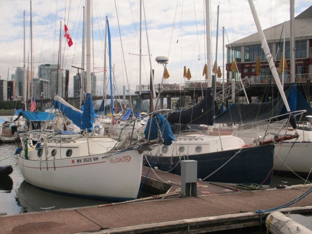
During this chore, I was visited by Simon, a local Flicka owner who saw me anchored when riding his bike shoreside. He came by on his inflatable stand up paddle board with his dog. Unfortunately, I do not recall the name of his Flicka nor the name of his dog. Simon is a young Englishman who immigrated to Vancouver to work in the flourishing film business. He purchased his Flicka from Seattle a couple of years earlier. His boat was also a 1985, so we were able to compare features, layouts, and modifications, and talked about our travels with the boats. This turned into a lengthy and enjoyable meeting, and he invited me over to check out his Flicka. After he left, I finished up the boat chores, tidied up, and paddled over to Stamps Landing where he was docked. We have the same hull with vastly different features. I have an outboard with no head, he has an inboard with an installed head. He has a dodger, radar, roller furling and an anchor windlass. I have none of those. The previous boat owner invested quite a bit of money into his boat while my Flicka has had little modification since its initial build. Still, they are clearly the same boat in the era with, in my opinion, the coolest oval portholes of all Flickas.
Searching for Simon’s Flicka
-

Sister Flicka
-

Simon’s Flicka 20 foredeck Layout
-
Simon’s Flicka 20 cockpit and stern layout
I took leave from Simon in time enough to get to the Granville Island Public Market. I wanted to get some provisions as I was running low on fresh food and was planning on leaving the next day. I had decided I’d had enough of the False Creek anchor show and the urban lifestyle of Vancouver was reminding me too much of Seattle. Simon had mentioned there was a grocer a few blocks inland that might offer quality goods for a more competitive price, but I found the market suited me fine. The produce was fresh, so I picked up some carrots, broccoli, bell peppers, grapes and the like, all satisfactorily in my budget. I also picked up some cod-fish for the evening’s supper. The Granville Public Market is the Pike’s Place of Vancouver and provides a large number of shops selling a variety of foods and artisan wares, as well as a variety of wares and artisan foods. It’s nice to be able to kayak to the store, and they have temporary moorage for shoppers. Still, I locked my tender up while I was there as I have limited trust for leaving gear unattended in Vancouver.
-
A birds-eye view of The Granville Island Public Market
-

On Granville Island
And from the docks. The purple kayak is my tender.

Accessible by boat
And from the docks again.

Security is a consideration in False Creek
A New Anchoring Technique. Using the chain of my stern anchor for added outboard security in the city.

Security is advised in False Creek
Bicycle Locks Doing Double Duty for Tender Security.

The morning was overcast and I awoke with a vision of Vancouver. I noticed there was a woman who seemed to be living aboard one boat and three men on another at the Govt. dock, so I thought to myself, “they must shower somewhere.” So I asked the woman and it turns out there are showers for the Govt. dock in Snug Cove. Who’d of thought? In Canada, the Govt. dock is a fairly common thing. Often they are used by fishing vessels, but in Bowen Island it is more used by folks coming over from the mainland on day trips to go to the Union Steamship Company Marina Resort, local restaurants tchotchke shops, and by water taxis. You pay by the honor system and it’s very economical with no amenities. For the head, you use the one provided nearby for public use and the ferry passengers. It turns out the shower was actually at the Resort, by the laundry room, but seperate from the facilities they have for their marina customers. It was rather nice so I enjoyed the hot water and my once a week shower.
I did some other chores and made ready to leave. As I was about to push-off, the ferry, the Queen of Capilano, came into the cove. It seemed prudent to wait for it to leave so as not to be subject to the prop wash that it was making and to not interfere with their operation. After it left, I started the motor but realized that I still needed the wash to settle down as it makes a tremendous amount of unpredictable swirling currents in the cove. While waiting, a Tollycraft with no fewer than 7 aboard comes into the Cove and was going to pull up to the dock on the opposite side. They saw me and asked if it was alright to dock there. In hindsight, I really wish I had said yes, but instead I explained that I wasn’t sure and that the signage said it was reserved for winter moorage a couple more days. So they aborted that spot and came over to my side. I said to them that they needed to wait until the ferry wash settled down, as I was doing, but they apparently did not understand. They made their approach and the current had its way with them. This became my problem because the current carried their boat uncontrollably into mine. I was in a bit of an uncompromising position as I was on the dock with my bow line in my hand when this happened. The many crew managed to fend off for the most part with only their rub rail making contact with my port side stantion and hull. That annoyed me and I emphatically expressed that it was imperative that they do not hit my outboard on the way in. My wordage at the time was much different. They managed to get to the dock without any further contact and I tied back up and inspected for damage and decided there wasn’t any and to not take further action concerning liability. There were apologies and lots of playing dumb on their end and they asked if they could help me in my departure. My words said “In light of what just happened I would very much prefer to do it myself.” My tone said “I don’t like you very much right now and I trust you even less.”

Point Atkinson, From Satellite……

…and From the Boat. Vancouver in the Background.
Looking Back at Howe Sound
I got off the dock without further incident and motored out of the cove. Once out, there was an outflow breeze from Howe Sound and I raised the jib and the main and broad reached toward Vancouver. Once to Point Atkinson though, I started to lose the outflow and the wind became light and variable. I made it around the point but I could see how you might want to give it a wider berth as the currents here tend to push you in its direction. I tried to work the boat the best I could in that light air, but finally gave in and motored through English Bay. I wanted to get into False Creek and secure an anchoring spot and permit before it was too late in the day.

English Bay. A moorage field for large ships awaiting loading and off-loading in Vancouver’s ports. English Bay is called such as this is where Captain Vancouver moored his fleet while exploring the area. The shoal area in the lower left corner is called the Spanish Banks, because that is where the Spanish fleet was moored at the same time.
I have been to False Creek previously and have gotten an anchoring permit before. Vancouver has implemented an anchoring permit system in an effort to keep live-aboards with unseaworthy boats from permanently mooring within the Creek. The permit is free and allows you to anchor 14 days out of the month in False Creek. Each month you can get a new permit. For the rest of the time, you must go elsewhere, which for the live-aboards appears to be out in English Bay near the entrance to the Creek. I assure you, that is a very exposed place to anchor and at times, terribly so. The gist is that if your boat can’t move, it would be considered unseaworthy and subject to a fine of $500 and/or impounding. This is the state of affairs and it creates quite a dynamic in the Creek. Once you observe it for a couple of days it is all very easy to understand.
The guide books explain that you must go to Stamps Landing to get your permit, yet the boating magazine 48 North had a current advertisement saying that there are three locations to get your permit. Go directly to Stamps Landing. False Creek Fuels is one of the faux locations. I stopped there first as I wanted to top up on fuel and was told I could get one at the Boaters’ Welcoming Center. After refueling I went to the Center, which also was on my way to the anchoring spot and the nice gentleman said I would have to go to Stamps Landing as they were the only ones to give out permits. He stated that I didn’t really need one as it was really meant for the live-aboards and that the City wanted me to be able to anchor here and visit. Without the Permit System, the live-aboards would monopolize the anchorage and visiting boats would not have room to anchor. While I did not inquire what a slip at a marina would cost, I suspect it to be a turn off to some thrifty Canadians (and myself.)

False Creek.
The image is not real-time, but you can see the plethora of boats anchored inside False Creek. Also visible is the park/green space surrounding the Creek.
I moved on to where I wanted to anchor and found a spot on the edge of the field. This was luck and strategy. Luck because there was a place for me, strategy because I wanted to be on the edge so as not to be completely surrounded by other anchoring and swinging boats. Once anchored and set, I pumped up the kayak and paddled over to Stamps Landing to get my permit. I had intended to play by the rules and get the permit as I “had no plan with the man” and it seemed prudent to do so. Seeing as I was only going to be there a couple of days, I really believe I did not need to have one and it appeared like many others did not bother. Still, it was free and easy enough. It is easy to tell the live-aboards from the tourists. The live-aboards have boats that don’t look like they are sailed often or ever (sailed, as in used to travel, whether sailboat or powerboat), and the tourists do. Because they do not travel, these aspects of the boat are typically neglected and this can be easily observed. If you are not investing in your boat, living at anchor is very low rent.
I locked up the boat, used an anchor chain to lock the outboard to the boat, figured out a way to lock the dinghy up and paddled ashore. Vancouver is notorious for vehicle break ins, so I figure that boats could also be subject to this. False Creek is surrounded by a park. This park provided public space, green space, bike and pedestrian lanes, water taxi docks and there are places to tie up your dinghy for free too. Tennis courts, monuments, historical information, benches and other curiosities are abundant. The Creek is surrounded by marinas and house boats and very little heavy industry. It appears to be well enjoyed by the inhabitants of the city on a summer day and gives the city a very European and progressive feel. At least in the park. In venturing out of the green space, it reminded me of Seattle and any other urban area, a money suck with noise and pollution and everyone on their cell phone running the rat race. Impressive, if you find those things impressive. I managed to escape the streets unscathed physically and financially, realizing it had nothing to offer me on this trip and retreated back to the green space and the Creek.
I paddled back to the boat and locked up the kayak. I checked that the anchor was doing as I expected, enjoyed the sunset, turned on the anchor light, ate some grub and watched the “circus” from the comfort of my own tiny, traveling, floating home.
Stats: TO – 11.31NM, MS – 6.1kts, MA – 3.4kts, TT – 3hrs, 50 mins, AD – ~18ft, AS – 60ft.
Misc.: 135mins of motor time, refueled, sussed locking up operations, reminded to not trust others and their boats.


