
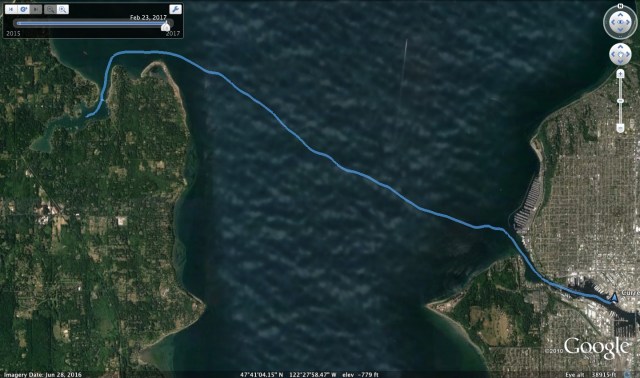
On Day 3, I went from Mats Mats to Port Townsend via the Port Townsend Canal and Port Hadlock. I originally planned to take my time in leaving, but upon checking the current chart for the Port Townsend Canal, I realized it would change to a flood earlier than I originally expected. The VHF weather forecast also said it would be blowing 20-25 knots from the South which would have these two elements opposing. A strong wind blowing against a strong current means short and steep waves. I was also recalling a dock mate telling me his experience in these conditions in this canal. It was a story of anxiety, so I quickly got ready and weighed anchor in a race to make it through before the current changed.
Sure enough, the wind was blowing as predicted which put us into Small Craft Advisory territory. Technically, my 20ft boat is considered a small craft, but it is built well, so it’s the inexperienced mariner part that applies most. I do not have an anemometer on board, so I have learned to guess the wind strength by the feel of the boat and the sail I can carry. I decided I would go straight to the second reef in the main sail, so I motored clear of the land, pointed into the wind, raised the sail, applied the reef points and then turned for the downwind sail. The seas were running and my little boat will roll and yaw quite a bit, so just when I had the boat pointed in the right direction, BAM!, the boom unexpectedly jibed across. I had not yet had a chance to rig the preventer or adjust the topping lift. The reefed sail area is quite small, so the force was not so great and the boom missed my head on the way across. What got me was the slack line for the first reef point which hadn’t been applied because I went straight to the second reef. It draped down below the boom in a loop and this went right across my face. I thought, “that’s going to leave a mark” but was most thankful it didn’t pull my eyewear off and send it overboard. With all this action, there is no time to check for beauty so I rigged the preventer, lowered the topping lift, tidied up the lines, raised the motor and got the boat settled in for the run.

My efforts to beat the flood to the canal were in vain. I could see the standing waves but was committed by this point. I said, “I can do this, in fact, the wind is strong enough, I think I can even sail through this.” I did lower the outboard and start it for ‘just in case,’ aimed for the center of the channel and sailed into the canal. Our forward progress was pretty slow, oscillating between .5 and 2 knots, but the south entrance was where the big waves were and once through that, my confidence level increased.

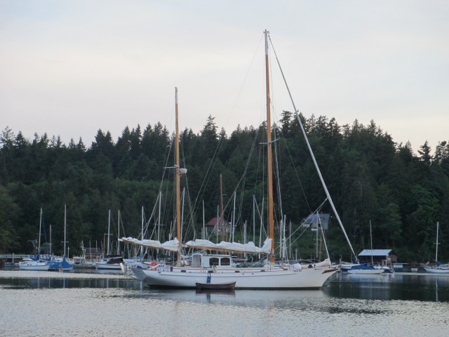
The wind was still blowing in Port Hadlock and I did not want to be in the anchorage off of Port Townsend if the South wind was also there. I decided to anchor in the lee of Irondale as it looked like there was a little protection there and wait it out. I got the idea from another boat that I saw do this. Here I cooked some lunch and tidied up the boat from the mornings rush. After a bit, I weighed anchor and sailed to Port Townsend. The wind direction had changed to the North, so it was a beat to windward to get there, however this is a favorable wind direction for anchoring in PT, where I planted the boat between the Boat Haven Marina and the Ferry Dock. I inflated the kayak with intentions of going ashore, but instead entertained guests whom came to me. First was my friend Bob from Admiralty Ship Supply, who brought his skiff out with some libations, and then Thomas the Pirate who was in town as a spectator for the start of the R2AK, which coincidentally was earlier that day.
TO – 15.91NM, MS – 6.4kts, MA – 2.9kts, TT – 6hr, 21min, AD – ~40ft, AS – 160ft
Misc. – Sailed in and out of anchorage at Irondale and into anchorage in PT.

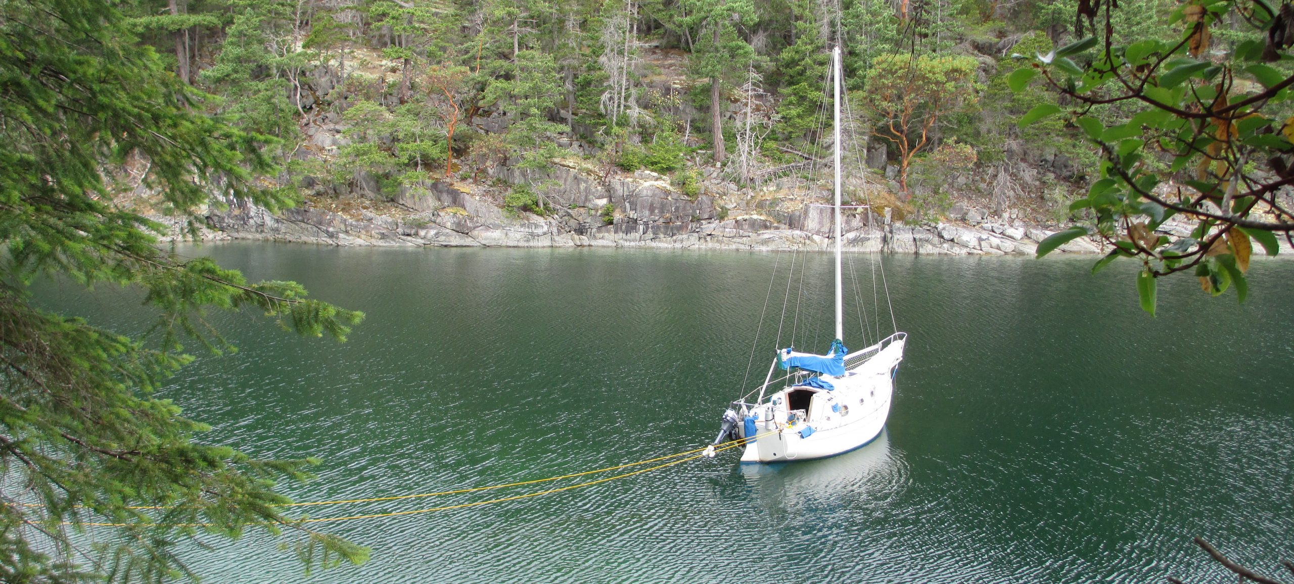
Mats Mats Bay
Day 2 took me from Port Madison to Mats Mats Bay. This was my second time to this enclosed bay surrounded by hills. If you can avoid the rocks outside and follow the range markers through the narrow, doglegged channel, you will find a very protected anchorage inside. Don’t worry, it gets a little less scary after the first time. First image below.
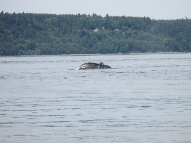
I got a 5am start in an attempt to catch the full flush of the ebb. However, my plan required some wind, which didn’t show up. Most folks would turn on the engine, but I held out. Did it pay off? I would say yes, but not by getting me to my destination quickly. I’ll explain. At Apple Cove Point, the ebb turned to flood and the very light north wind had me slowly zig-zagging back and forth with very little forward progress. Second image below. Then I saw a whale surface in the distance. Ok, cool, it will need to resurface at some time, right? Sure enough, it surfaced about 100 years behind me, startling me quite a bit. It was a humpback whale and when they exhale through their blowhole, it is quite loud. This whale continued to dive in the riptide off of Apple Cove Point for about 45 minutes while I went nowhere fast. I tried to get a good picture of the fluke, but alas, this was the best I came up with. Third image. So the whale watching was the pay off. Unfortunately, the sailing and the picture taking were not the finest.


Eventually the north wind picked up and I was able to get up around Point No Point, but the breeze was not found all that long. As I realized I was going to run out of daylight, I “motored up” to make sure I got into Mats Mats Bay before dark.
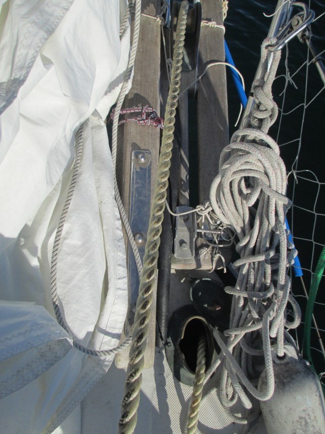
Before I left on my June trip, I set up some chafe gear on the bowsprit and on the bobstay. Practice had shown me that the anchor rode and anchor can rub on these places and the chafe gear is an effort to preserve both the line and the sprit. Through my trip, I found this to work successfully. However, one drawback of Mats Mats Bay is that it is an old logging bay. This is actually true of many bays in the northwest. You are never really sure if there isn’t 100 year old logs or logging gear abandoned at the bottom of the bay to foul your anchor and chafe your anchor rode. When I pulled up the anchor the next morning, I discovered that I had likely found some of this debris. The bottom 30ft of my anchor rode had some evidence of chafe. This is a good reason to have an all-chain rode. One drawback of having such a small boat is that having 300ft of anchor chain is too much weight to carry that far forward in the bow. I have compromised with 30ft of chain and 270ft of 5/8″ nylon line. The line is a bit oversized to give an extra safety factor which worked in this case. The chafe is not too bad so it is not a worry at this time and because it is on the end, I could always trim it off if I needed to. I had no further issues on the trip, but duly noted. Chafe is your enemy.


Stats: TO – 29.53NM, MS – 5.4kt, MA – 2.1kt, TT- 16hr, 2min, AD ~ 18ft, 100ft of scope.
Misc. – Ran the Spinnaker lines for faster spinnaker set up, practiced light air sailing with success by adjusting the genoa twist with the car placement and the mainsail twist with the traveler placement. Spent a long, slow day in the sun.
 Port Madison
Day 1 got me off the dock and out the locks. There’s rarely an early get away with the last minute prep and exiting the canal. This is not a problem though, as I find it nice to get clear of the dock and the city and get settled into the boat at a nearby spot. You wake up the next day and don’t have any of both the mental and physical shore ties to escape from. It’s just go time. Traditionally I have done this in Kingston, but the anchorage in Port Madison has become a favorite over the past couple of years. It’s close, quiet, well protected and since one of my focuses was going to be anchoring on this trip, it was a very appropriate first stop.
I shared the anchorage with the elegant boat pictured below, Irene. Notice how calm the waters are in this anchorage. I didn’t bother inflating the kayak that day and just stayed on the boat. This turned out to be a trend over the next few days on the way to Port Townsend and suited me fine.
Here’s another view from the “front porch” with Irene, straight ahead. I did a few chores and had a nice meal and settled into one of the stack of library books I had checked out for the trip. Most of these were guide books, but a big read for me on this trip was One Island, One Ocean. It has some great photos in it and was easy to read in small segments before going asleep. It’s geared more for the non-sailor and they were definitely pitching a message, yet I sill found it quite interesting.

Stats: Trip Odometer(TO) – 8.6NM, Maximum Speed(MS) – 5.7kt, Moving Average(MA) – 3.1kt, Total Time(TT) – 4hr, 01min, Anchor Depth(AD)~22ft, 90ft of scope.
Misc.: Lubed the sail tracks, put tell tales on the leech of the main.
While Port Madison is close to Seattle, it feels like a world away when your tucked into Inner Harbor which provides good shelter and shallow anchoring depths. The most striking part is how loud the birds seem. I say seem, because if I marvel at it too closely, I can hear in the distance the traffic on Agate Pass Bridge and the train going up the mainland coast, and the not so distant sound of landscaping and construction. Still, it is impressive that I have traveled only 7.76 NM from my slip and it is difficult to tell an urban center such as Seattle is so close.


Thanks to Google Earth and Garmin, you have the answer. I have only given out small bits of information so far. If you are local to Seattle, come to my Sailing Presentation for a more personal account. I think I am better in person.

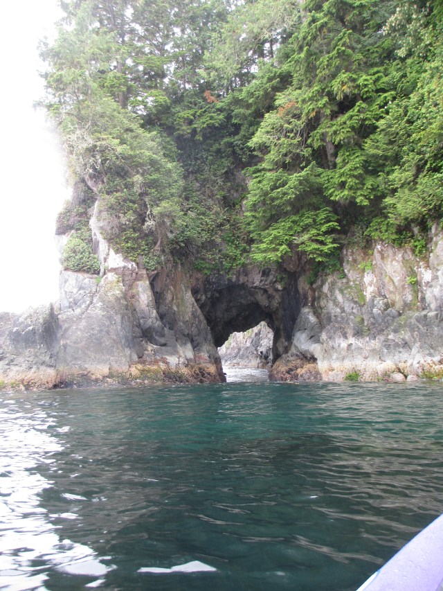
I circumnavigated Effingham Island while anchored in Effingham Bay. The back side of the island was the weather side with rock formations and a sea arch that I paddled the kayak through. In the photo, you can see the swell pushing through, so it took a bit of timing. There is also a beach, an old native village site, with a plethora of tide pools and cool marine life.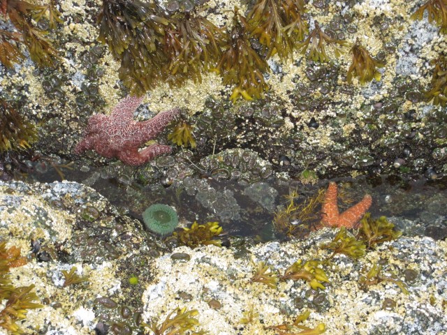
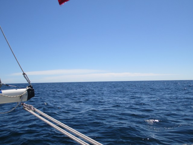
Leaving Hot Springs Cove and sailing on the outside of Flores Island was my farthest offshore passage. I was about 6.5 NM off at my furthest. There was just enough following wind to fill the sails and overcome the rolling of the boat from the ocean swells.
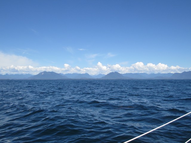
To the east – beautiful and rugged Vancouver Island.
To the west – I think I see Hawaii! Or is that Japan?
Hot Springs Cove was my farthest point north and my turn around goal. It was pretty sweet. I stayed there 2 days and made 2 trips to the springs. It is a 2 KM hike each way along a boardwalk to get there and it is best to go there very early in the morning or in the evening as the tour boats and float planes parade in hordes of people from Tofino during “business hours.” The springs can only accommodate about 8 people at a time so I suspect it is very crowded at that time.


 On my way to Hot Springs Cove, heading down Sydney Inlet, I came across a group of Sea Otters. They seemed curious but kept their distance. If I got too close, they would roll and dive.
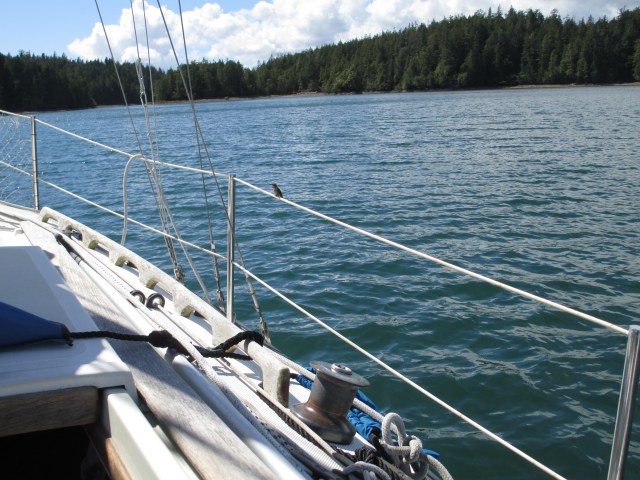
This is while anchored in Joe’s Bay in the Broken Group in Barkley Sound. As soon as I entered I was swarmed by hummingbirds. I’ve never seen anything like it. They were unafraid. They would fly inside the boat. They would try to feed from my jacket. Below the are trying to feed from the red cap on my solar shower. Even though they were ever-present(they did disappear at sundown, but reappeared in the morning), they dart so fast that they are difficult to photograph.