June on the Hook – Day 18 – Princess Bay, Portland Island

I made another early start from Telegraph Harbor. My plan was to catch the ebb tide down through Sansum Narrows, on the west side of Salt Spring Island. In combination with a north breeze, this should get me down to the Southern Gulf Islands and possibly to the San Juans. I had never been through Samsun Narrows and I felt like it could be a shortcut with favorable tidal currents of 3 knots. Making it to the San Juans was a lofty goal that would depend on optimum sailing conditions and a motor. Going through customs and anchoring need to be considered too.
The Comic Drift
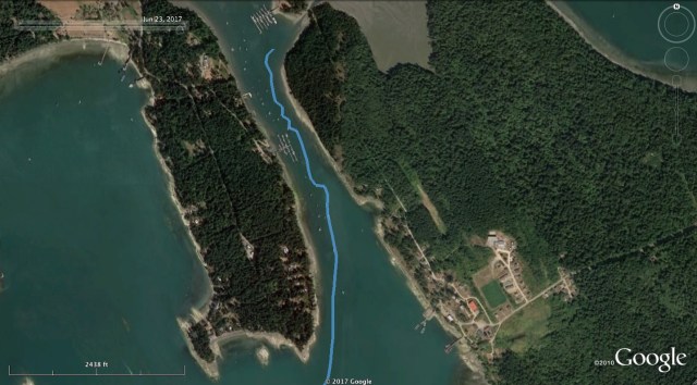
At 5:30am, I weighed the anchor in Telegraph Harbor and started my drift out. I say drift because the sun was up but the wind was not. I had the main and jib raised and the only draw I was getting in the sails was from the air flow caused by my fraction of a knot drift. I tacked a few times and gybed once to stay in the narrow channel and avoid buoyed boats. The scene was kind of ridiculous, but the idea of starting the motor on the quiet and peaceful morning was unappealing too. I stubbornly held out for the breeze that I was sure was going to set in anytime from the north.
Waiting it Out
I worked the sails for any air movement I could harness to get into Stuart Channel. I was putting quite a bit of effort into getting the most out of the light and variable winds and getting little reward. So I boiled some eggs, I ate some salad, I drank some tea and watch the world (at least Canada) go buy at a snail’s pace. I still had the ebb tide but that was not going to last beyond noon. At this rate I was not going to make the San Juans and I was beginning to doubt I would even make it through Sansum Narrows.
Sailing Through Sansum Narrows
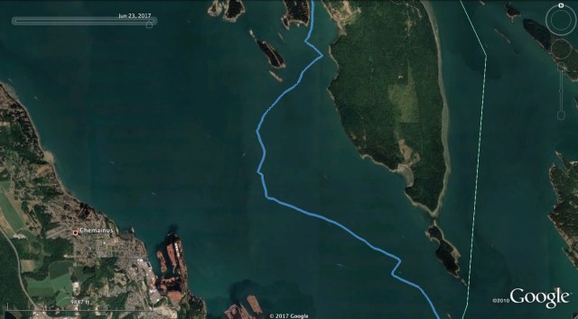
Finally about 10am the N wind filled in. Maybe 10 knots? This was enough to set me on my way. I wanted to put the genoa up, but decided against it with the uncertain shroud. I would have to settle with the main and the working jib. The narrowest part of Samsun Narrows is brief, but the full channel as it winds through the gap between Salt Spring Island and Vancouver Island is several miles (nautical? kilometers?) long. This results in elevated tidal currents along its length which can be a 1-4 knot boost over the distance. Of course, it can be a 1-4 knots against too. The four and a half hours lost waiting for the wind to appear would prove to be significant. I will confess that had I turned the motor on in the beginning and taken full advantage of the tidal cycle, I would have likely arrived at Portland Island having run the motor less time than I eventually did. The motor is such a bore to me that I make these choices.

Baynes Peak, Sansum Narrows

Looking North
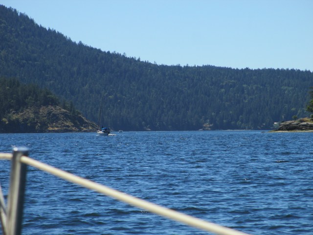
The Narrow Bit
But for now, I still had a favorable tide and wind so I wished myself along as fast as possible. I gybed my way through the channel with the good following wind which was winding through the channel too. I heard the rig creak a few times and this got my attention, but kept on. As I approached the narrow part of the channel, the swirling currents kept me on my guard. I mentally went through the steps of lowering the motor and getting it started. The whirlpools wanted to set me toward the rocks or the shore and it was difficult to tell which way the current was truly flowing. The wind was still pushing me south and out of the swirling clutches of current, but my progress was slowing and I could see that the wind was diminishing the farther down the strait I went.

Looking Back Through the Narrows. Tide Rips to the Right.
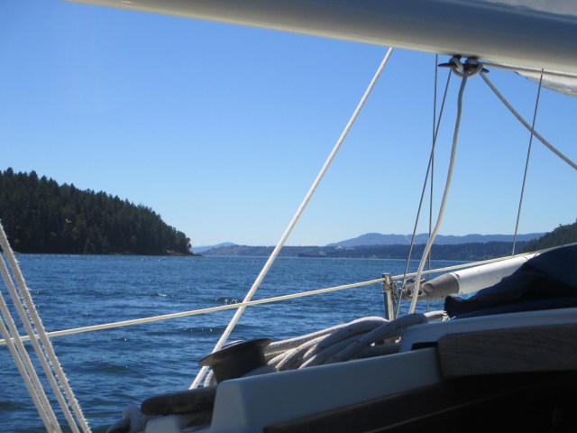
Looking South, Almost Through.
Where the Wind Ends
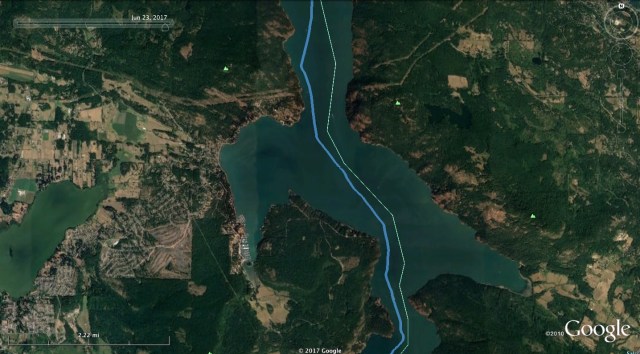
I thought I was going to be able to sail all the way through the channel, but alas, it was not to be. The wind became light and the current adverse. I gybed back and forth a few times to see if I could work my way through, but while the flood tide was picking up, the wind was not. I gave in and started the motor. It was about 12:40pm and I escaped the grips of the Narrows, but had an afternoon of heading straight into a 1-2 knot flood tide with plenty of sunshine, but no wind. This is Satellite Channel that feeds Saanish Inlet and the Sansum Narrows and I could see that with a following tide, one could make great progress and, at least under motor, and easily make the trip to or from the northern gulf islands in a day.
Satellite Channel and Against the Tide
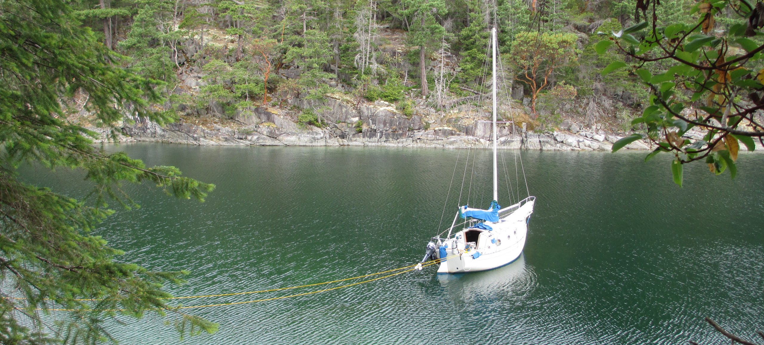
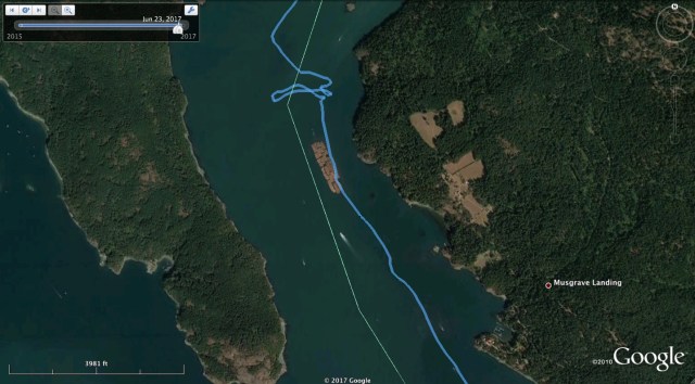
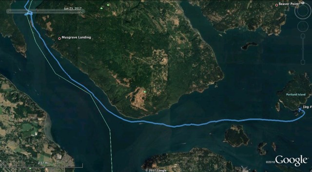
I spent the next three and a half hours motoring against the tide to Princess Bay on Portland Island. Portland Island is part of the Gulf Islands National Park Reserve and I arrived to a nearly full anchorage. I thought one boat was leaving, but they were just reanchoring. I was faked out by another boat starting its motor, but maybe to charge its batteries. I finally found a spot that I was satisfied with and I dropped the hook in 18 ft of water at about mid tide. In the process of grabbing my leadline to check the depth, I knocked the anchor rode chafe guard into the bay. It is just a spiral cut piece of hose, so nothing fancy and I had extra hose to make a replacement. However, I didn’t like the idea that I had just lost plastic tubing into the Park Reserve and if the chafe guard had been returned to its proper storage place, it would not have fallen in.

Portland Island

Princess Bay from Satellite
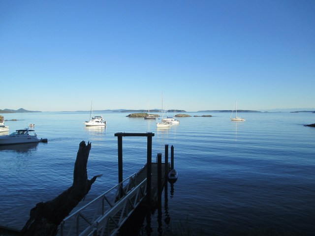
Princess Bay From the Dinghy Dock. Sampaguita is in the Center. The Kayak is at the Dock.
I tidied up the boat, made a new chafe guard and thought it through. With water levels at 18 feet and rising, I could not really see the bottom of the bay, but tomorrow at about 9am the tide will be low and the water level should be around 12 feet. Maybe I can formulate a plan of retrieval for that time. If conditions permit, I will be able to see the bottom, locate the hose and have the correct sized tools to fish it out.
A few more boats entered the anchorage and found spots either on the fringes or stern tied to the shore. While I ways happy with how I was set, I saw a bit of reanchoring going on and anchors coming up with lots of weeds on them. I inflated the kayak for the first time since False Creek and headed ashore. There is a dinghy/ranger dock in the bay and there are well-marked trails intersecting the Island. The island has a long and interesting history of being inhabited, evident by the 3000-year-old midden beach and the more recent 100-year-old orchard planted by Hawaiians.
After a couple of loops and 2-3 miles I headed back to the dinghy and the Flicka. I ate dinner and did some reading. The night was beautiful and you could see the bioluminescence in the bay when you disturbed the water. The clear skies meant the stars and the Milky Way were in full view. This was my last night in Canada for this trip. I was moving forward and would head to Friday Harbor to regroup.
Stats: TO – 27.09NM, MS – 5.6kt, MA – 2.6kt, TT – 10hr, 44min, AD ~ 18ft, AS – 75ft.
Misc.: Motor time – 210min., some mosquitos, anchorage so-so, trails are good and the Island is interesting, popular as it is a quick overnight/day trip from Sidney.
Discover more from Sailing With Josh
Subscribe to get the latest posts sent to your email.


chalanges abound ay ? it appears that the evening had its rewards did you find & retreve the chafe guard ?
LikeLike